
Image: O'Hare International Airport (USGS) Phase2-corrected
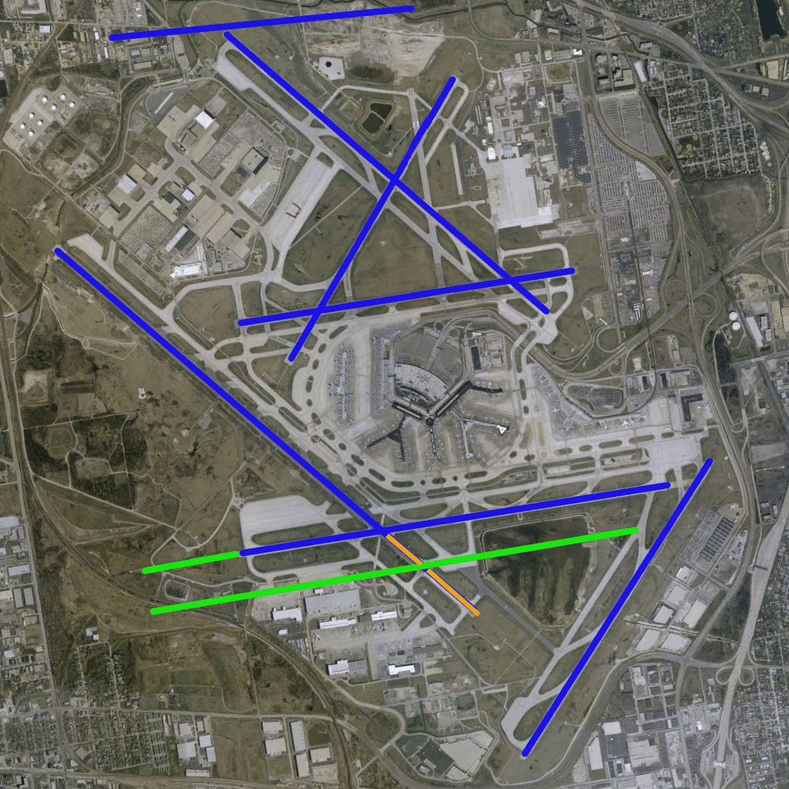
Description: en:O'Hare International Airport modernization program - phase 2 runway configuration (blue = existing, green = new, orange = removed)
Title: O'Hare International Airport (USGS) Phase2-corrected
Credit: NASA World Wind Screenshot, USGS urban ortho; [1]
Author: This image is in the public domain in the United States because it only contains materials that originally came from the United States Geological Survey, an agency of the United States Department of the Interior. For more information, see the official USGS copyright policy. Български | Català | Čeština | Deutsch | English | Español | Eesti | فارسی | Suomi | Français | Galego | Italiano | 日本語 | 한국어 | Македонски | മലയാളം | Nederlands | Polski | Português | Русский | Sicilianu | Türkçe | 中文 | 中文(简体) | +/− Runway overlay by User:Wangi. User:brianski removed erroneous runway 18/36, which was decomissioned seperately in 2003.
Usage Terms: Public domain
License: Public domain
Attribution Required?: No
Image usage
The following page links to this image:

_Phase2-corrected.png)