
Image: Occupied Palestinian Territories
Size of this preview: 393 × 599 pixels. Other resolutions: 157 × 240 pixels | 1,895 × 2,889 pixels.
Original image (1,895 × 2,889 pixels, file size: 949 KB, MIME type: image/jpeg)
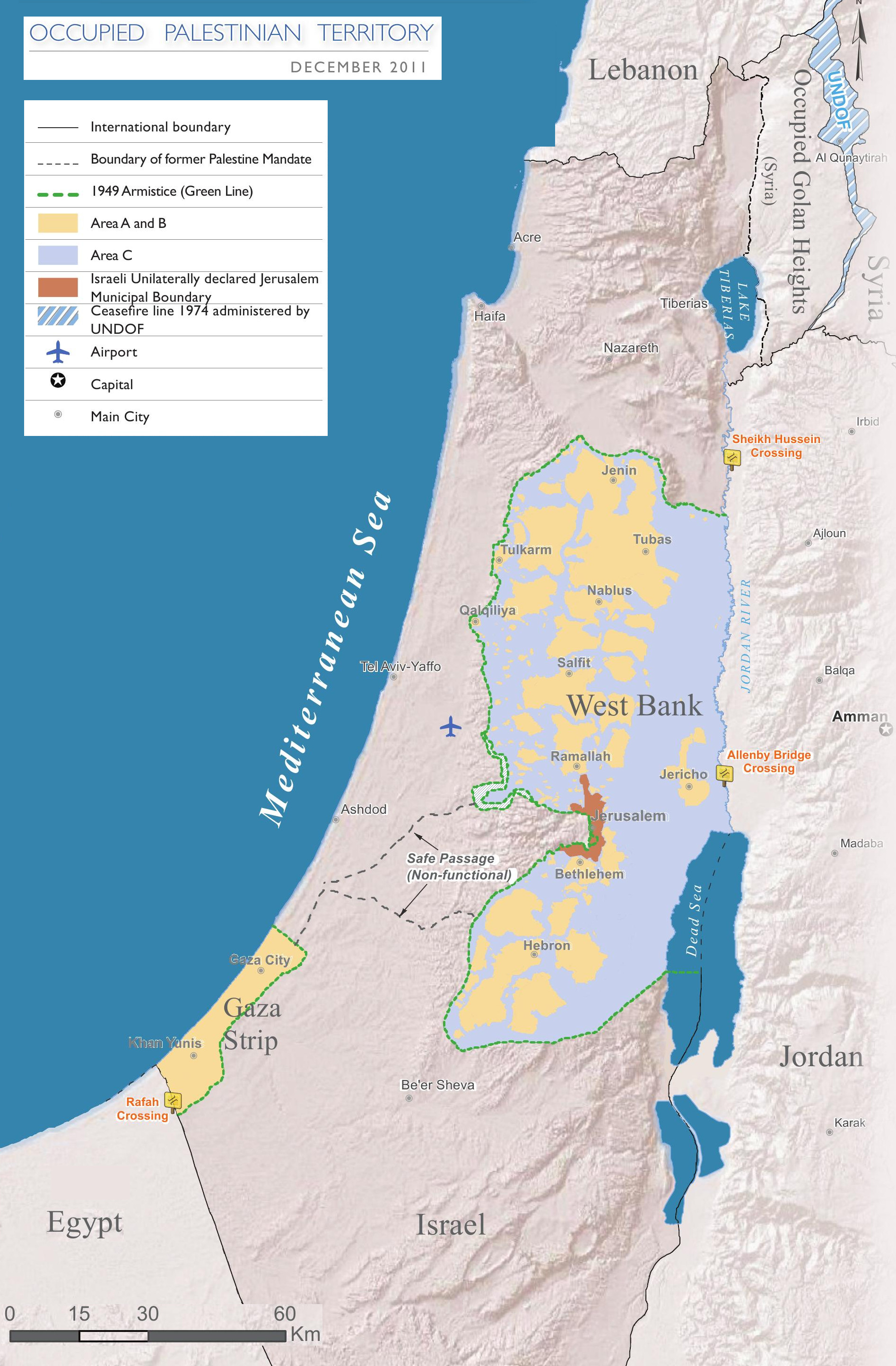
Description: Map of the Occupied Palestinian Territories (West Bank and Gaza Strip), marked by the Green Line. Based on Reference Map: occupied Palestinian territory: Overview Map, as of December 2011. Published by United Nations Office for the Coordination of Humanitarian Affairs (OCHAoPt), 25 January 2012
Title: Occupied Palestinian Territories
Credit: Own work, based on http://www.ochaopt.org/documents/ochaopt_atlas_opt_general_december2011.pdf on [1]
Author: Wickey-nl
Usage Terms: Creative Commons Attribution-Share Alike 3.0
License: CC BY-SA 3.0
License Link: https://creativecommons.org/licenses/by-sa/3.0
Attribution Required?: Yes
Image usage
The following 3 pages link to this image:

All content from Kiddle encyclopedia articles (including the article images and facts) can be freely used under Attribution-ShareAlike license, unless stated otherwise.