
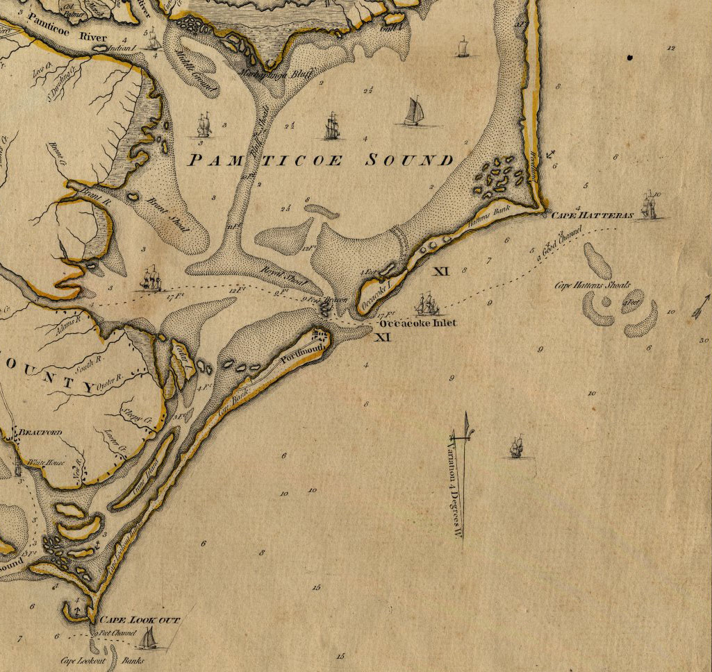
Image: Ocracoke inlet north carolina 1775
Size of this preview: 635 × 600 pixels. Other resolutions: 254 × 240 pixels | 1,025 × 968 pixels.
Original image (1,025 × 968 pixels, file size: 333 KB, MIME type: image/jpeg)
Description: An Accurate Map of North and South Carolina With Their Indian Frontiers, Shewing in a distinct manner all the Mountains, Rivers, Swamps, Marshes, Bays, Creeks, Harbours, Sandbanks and Soundings on the Coasts; with The Roads and Indian Paths; as well as The Boundary or Provincial Lines, The Several Townships and other divisions of the Land in Both the Provinces; the whole from Actual Surveys By Henry Mouzon and Others.
Title: Ocracoke inlet north carolina 1775
Credit: http://ncrec.dcr.state.nc.us/Cat/CatServer.ASP?WCI=MainEP&WCE=ViewMap&WCU=3.3.1.1.258;i
Author: from Actual Surveys By Henry Mouzon and Others.
Usage Terms: Public domain
License: Public domain
Attribution Required?: No
Image usage
The following 2 pages link to this image:

All content from Kiddle encyclopedia articles (including the article images and facts) can be freely used under Attribution-ShareAlike license, unless stated otherwise.