
Image: Ohridski-Map
Size of this preview: 475 × 600 pixels. Other resolutions: 190 × 240 pixels | 2,849 × 3,598 pixels.
Original image (2,849 × 3,598 pixels, file size: 29.38 MB, MIME type: image/png)
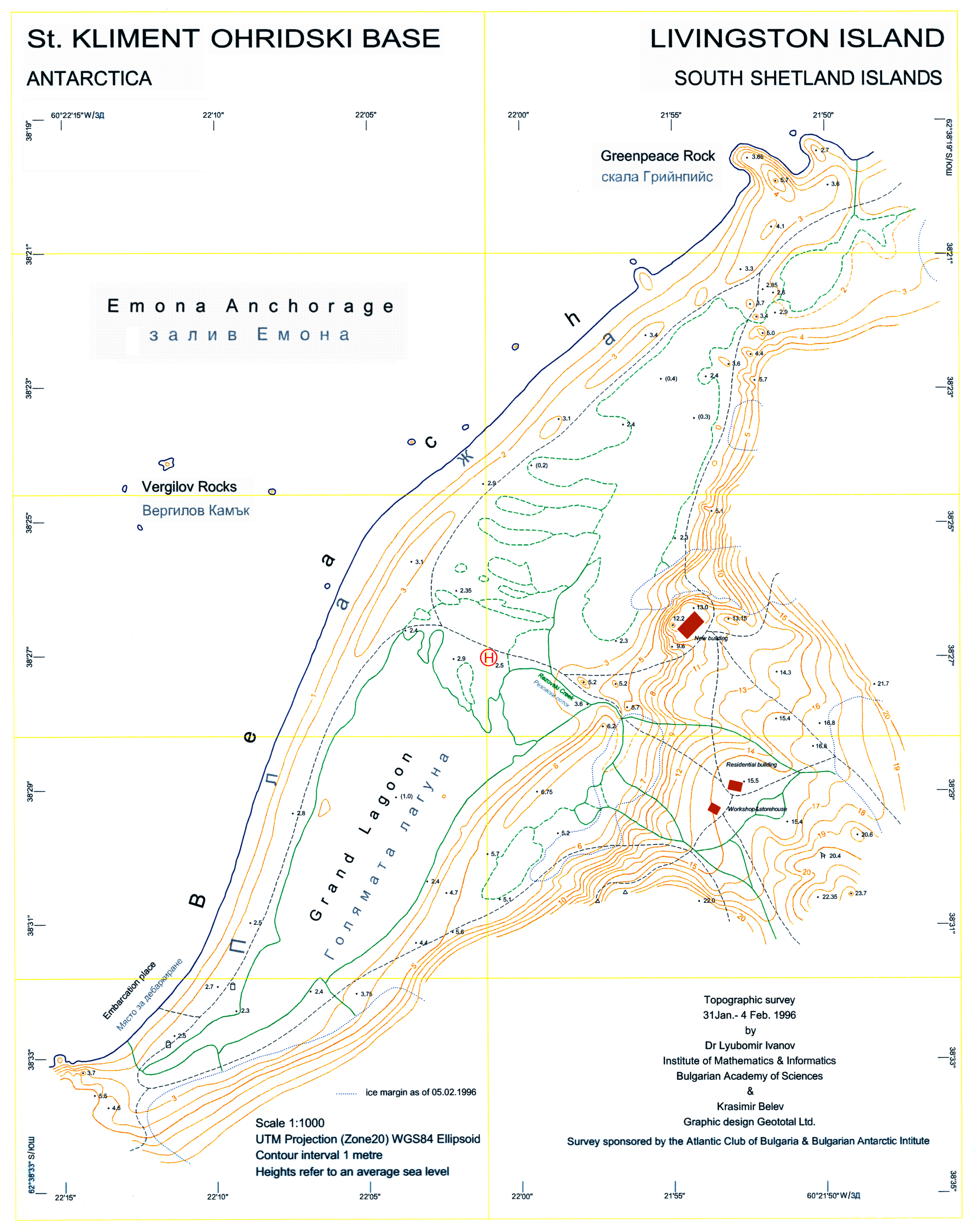
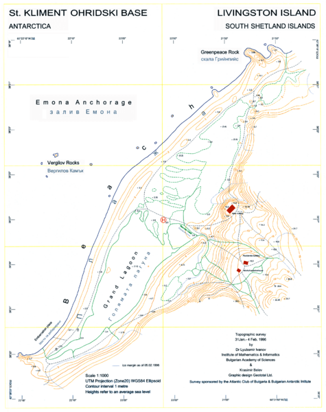
Description: L.L. Ivanov, St. Kliment Ohridski Base, Livingston Island, 1:1 000 scale topographic map, Commissioned by the Antarctic Place-names Commission of Bulgaria, sponsored by the Atlantic Club of Bulgaria and the Bulgarian Antarctic Institute, Sofia, 1996. The first Bulgarian Antarctic topographic map. Note: 'New building' actually refers to the foundations of the new main building of the Bulgarian Base as of 1996; the building itself was completed in 1998.
Title: Ohridski-Map
Credit: Own work
Author: User:Apcbg
Usage Terms: Creative Commons Attribution-Share Alike 4.0
License: CC BY-SA 4.0
License Link: https://creativecommons.org/licenses/by-sa/4.0
Attribution Required?: Yes
Image usage
The following page links to this image:

All content from Kiddle encyclopedia articles (including the article images and facts) can be freely used under Attribution-ShareAlike license, unless stated otherwise.