
Image: Old River Control Structure Complex

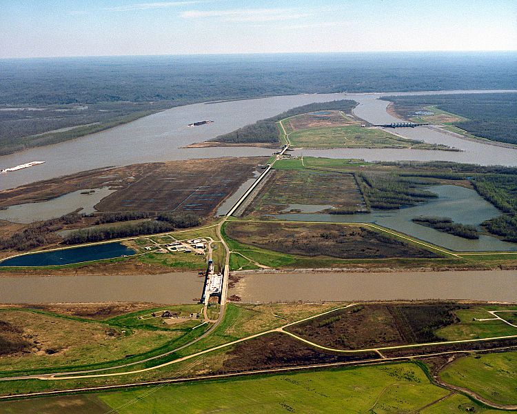
Description: The Old River Control Structure at the juncture of the Mississippi River and the Atchafalaya River. In this photograph, the Mississippi River runs along the left and curves away to the right in the distance. The Atchafalaya River meets the Mississippi at three points and runs off to the bottom right. Control structures (dams) at each of the three forks of the Atchafalaya prevent most of the waters of the Mississippi from running into the Atchafalaya. The design of the structures is intended to keep 70% of the water in the Mississippi and 30% flowing into the Atchafalaya. View is to the east-southeast. The control structures are located at river mile 315 on the Mississippi (315 miles from the Gulf of Mexico). On the left of the river in this photograph is Wilkinson County in the State of Mississippi. Concordia Parish, Louisiana is on the right.
Title: Old River Control Structure Complex
Credit: U.S. Army Corps of Engineers Digital Visual Library Image page Image description page Digital Visual Library home page
Author: Michael Maples, U.S. Army Corps of Engineers
Permission: This image or file is a work of a U.S. Army Corps of Engineers soldier or employee, taken or made as part of that person's official duties. As a work of the U.S. federal government, the image is in the public domain. English | italiano | Nederlands | русский | Türkçe | українська | +/−
Usage Terms: Public domain
License: Public domain
Attribution Required?: No
Image usage
The following 2 pages link to this image:
