
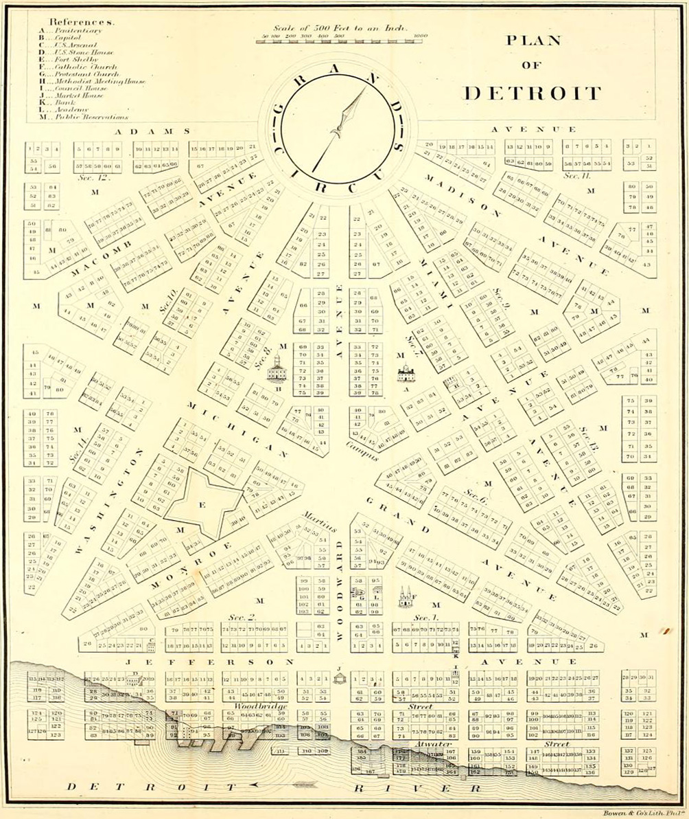
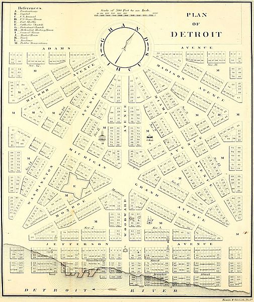
Image: Old map 1807 plan
Size of this preview: 505 × 600 pixels. Other resolutions: 202 × 240 pixels | 1,004 × 1,192 pixels.
Original image (1,004 × 1,192 pixels, file size: 519 KB, MIME type: image/jpeg)
Description: Detroit city layout plan circa 1807—following the 1805 fire that destroyed most of the city. The map showes Grand Circus Park (top), and some of the present-day Grand Circus Park Historic District.
Title: Old map 1807 plan
Credit: Dickens, Asbury , ed. (1860) American State Papers, Volume VI, Public Lands, Washington, DC: Gales & Seaton, p. 299
Author: Unknown
Usage Terms: Public domain
License: Public domain
Attribution Required?: No
Image usage

All content from Kiddle encyclopedia articles (including the article images and facts) can be freely used under Attribution-ShareAlike license, unless stated otherwise.