
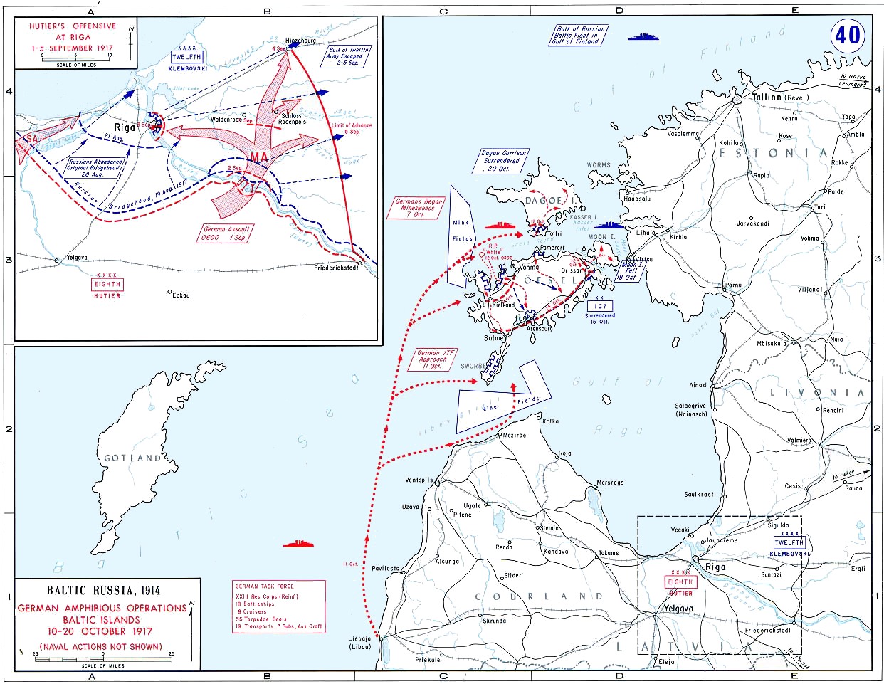
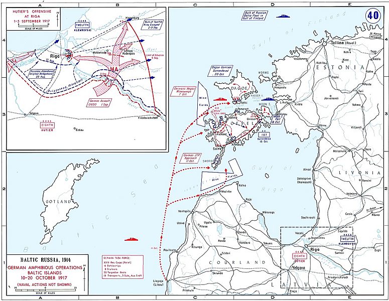
Image: Operation Albion Map
Size of this preview: 775 × 600 pixels. Other resolutions: 310 × 240 pixels | 1,242 × 961 pixels.
Original image (1,242 × 961 pixels, file size: 311 KB, MIME type: image/jpeg)
Description: Map showing amphibious operations of Operation Albion, Baltic Islands, 10 - 20 October 1917, and Hutier's Offensive at Riga 1 - 5 September 1917 (inset)
Title: Operation Albion Map
Credit: United States Military Academy Campaign Atlas to the Great War. http://www.dean.usma.edu/history/web03/atlases/WorldWarOne/WWOneJPG/WWOne40.jpg
Author: United States Military Academy
Permission: This image is a work of a U.S. Army soldier or employee, taken or made as part of that person's official duties. As a work of the U.S. federal government, the image is in the public domain.
Usage Terms: Public domain
License: Public domain
Attribution Required?: No
Image usage
The following 2 pages link to this image:

All content from Kiddle encyclopedia articles (including the article images and facts) can be freely used under Attribution-ShareAlike license, unless stated otherwise.