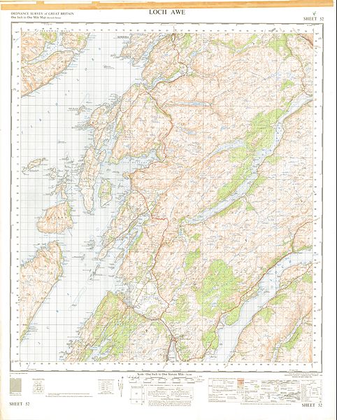
Image: Ordnance Survey One-inch Sheet 52 Loch Awe, Published 1956

Size of this preview: 482 × 600 pixels. Other resolutions: 193 × 240 pixels | 8,604 × 10,703 pixels.
Original image (8,604 × 10,703 pixels, file size: 19.42 MB, MIME type: image/jpeg)
Description: OS Map covering Loch Awe, parts of Loch Fyne and the Firth of Lorne, Seil, Luing, Easdale, the Garvellachs, Scarba, Gulf of Corryvreckan, Lochgilphead, Kilmartin, the Crinan Canal, and parts of Kerrera and The Isle of Mull, on the West Coast of Scotland, at a scale of 1:63,360 or one inch to one mile.
Title: Ordnance Survey One-inch Sheet 52 Loch Awe, Published 1956
Credit: OS One-inch Sheet 52 Loch Awe
Author: Director General of the Ordnance Survey, Chessington, UK
Usage Terms: Public domain
License: Public domain
Attribution Required?: No
Image usage
The following page links to this image:

All content from Kiddle encyclopedia articles (including the article images and facts) can be freely used under Attribution-ShareAlike license, unless stated otherwise.
