
Image: Orlando-Kissimmee Florida Metropolitan Statistical Area

Size of this PNG preview of this SVG file: 619 × 600 pixels. Other resolution: 248 × 240 pixels.
Original image (SVG file, nominally 1,001 × 970 pixels, file size: 252 KB)
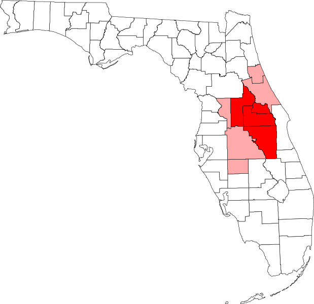
Description: Map of Florida showing the Orlando-Kissimmee Florida Metropolitan Statistical Area highlighted in red, along with the rest of the Orlando-Deltona-Daytona Beach Combined Statistical Area highlighted in light red. Based on information from the US Census Bureau and created with a custom script.
Title: Orlando-Kissimmee Florida Metropolitan Statistical Area
Credit: Own work
Author: Arkyan
Usage Terms: Creative Commons Attribution-Share Alike 3.0
License: CC BY-SA 3.0
License Link: http://creativecommons.org/licenses/by-sa/3.0
Attribution Required?: Yes
Image usage
There are no pages that link to this image.

All content from Kiddle encyclopedia articles (including the article images and facts) can be freely used under Attribution-ShareAlike license, unless stated otherwise.