
Image: OstmarkMap
Size of this preview: 800 × 568 pixels. Other resolutions: 320 × 227 pixels | 2,360 × 1,676 pixels.
Original image (2,360 × 1,676 pixels, file size: 293 KB, MIME type: image/png)
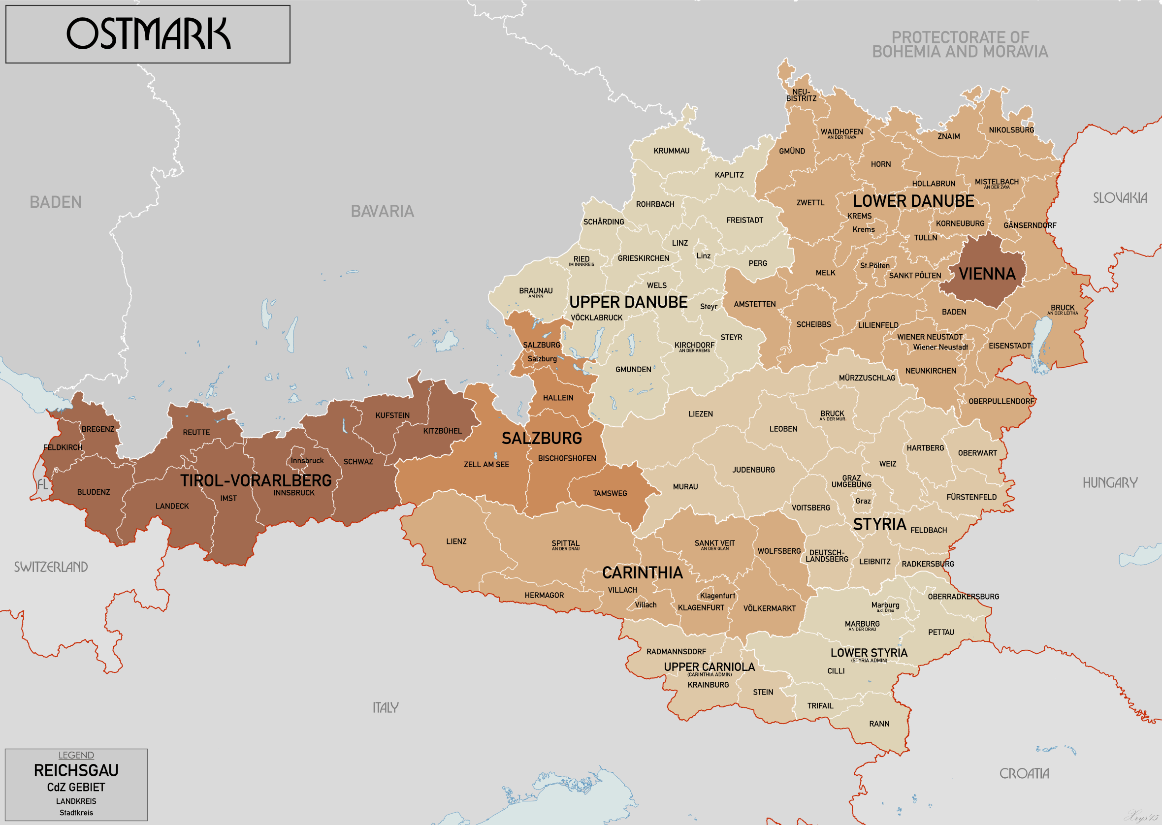
Description: Administrative map of Ostmark in 1941. Showing Reichsgaue and CdZ Gebiete subdivided into Landkreise and Stadtkreise. Source map data: Karte von Mitteleuropa 300k, Karte des Deustchen Reiches 100k. Source map site www.mapywig.org.
Title: OstmarkMap
Credit: Own work
Author: XrysD
Usage Terms: Creative Commons Attribution-Share Alike 4.0
License: CC BY-SA 4.0
License Link: https://creativecommons.org/licenses/by-sa/4.0
Attribution Required?: Yes
Image usage
The following page links to this image:

All content from Kiddle encyclopedia articles (including the article images and facts) can be freely used under Attribution-ShareAlike license, unless stated otherwise.