
Image: Oswegorivermap
Size of this preview: 600 × 600 pixels. Other resolutions: 240 × 240 pixels | 1,000 × 1,000 pixels.
Original image (1,000 × 1,000 pixels, file size: 414 KB, MIME type: image/png)
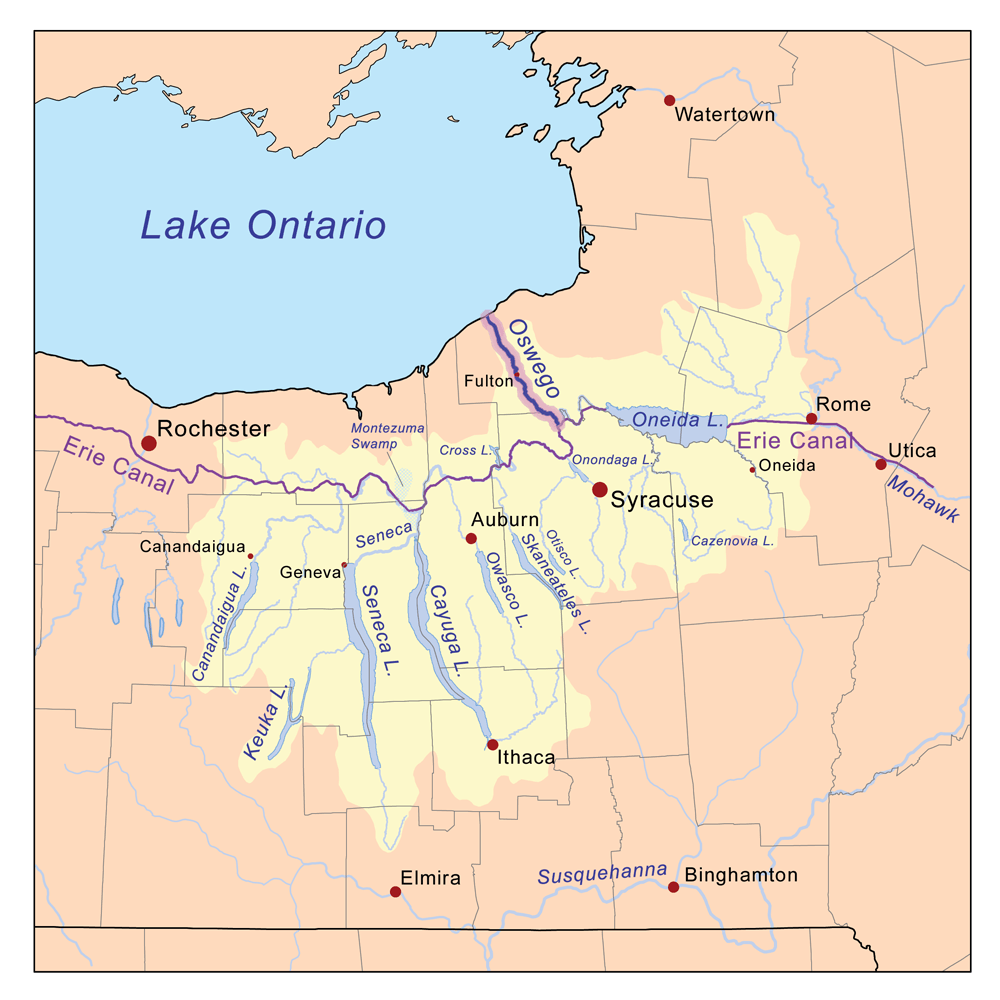
Description: This is a map of the Oswego River drainage basin, with the Oswego River highlighted. It was created based on USGS data. The current route of the Erie Canal is shown, which differs substantially from the 1825–1916 route.
Title: Oswegorivermap
Credit: Own work
Author: Karl Musser
Usage Terms: Creative Commons Attribution-Share Alike 3.0
License: CC BY-SA 3.0
License Link: http://creativecommons.org/licenses/by-sa/3.0
Attribution Required?: Yes
Image usage
The following 3 pages link to this image:

All content from Kiddle encyclopedia articles (including the article images and facts) can be freely used under Attribution-ShareAlike license, unless stated otherwise.