
Image: Otago Peninsula from Mount Cargill
Size of this preview: 800 × 114 pixels. Other resolutions: 320 × 45 pixels | 6,147 × 874 pixels.
Original image (6,147 × 874 pixels, file size: 857 KB, MIME type: image/jpeg)
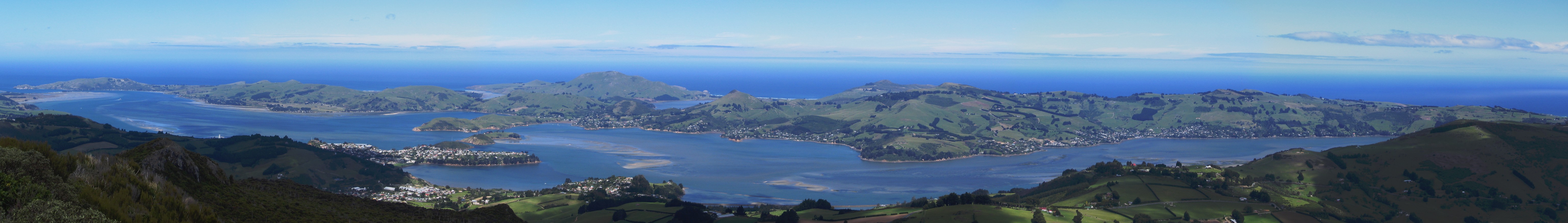
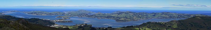
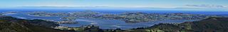
Description: Panorama of Otago Peninsula, New Zealand, taken from Mt. Cargill looking southeast across Otago Harbour, stitched together with Hugin. The mainland is mostly shadowed by clouds, field of view approx 90 degrees. On the extreme left are the harbour mouth, Aramoana and Taiaroa Head. Near the centre is Harbour Cone, and below it Broad Bay. Portobello and Macandrew Bay are to the left and right respectively. Quarantine Island is visible in the mid left above Port Chalmers.
Title: Otago Peninsula from Mount Cargill
Credit: Own work
Author: Benchill
Usage Terms: Public domain
License: Public domain
Attribution Required?: No
Image usage
The following 2 pages link to this image:

All content from Kiddle encyclopedia articles (including the article images and facts) can be freely used under Attribution-ShareAlike license, unless stated otherwise.