
Image: Ottawabonnecheregrabenmap
No higher resolution available.
Ottawabonnecheregrabenmap.png (600 × 525 pixels, file size: 446 KB, MIME type: image/png)
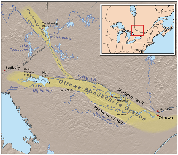
Description: This is a map of the Ottawa-Bonnechere Graben. Elevation data and U.S. boundaries from USGS, Canadian boundaries and hydrology from Digital Chart of the World. Ottawa-Bonnechere Graben boundaries based on elevation data with [1], [2], [3], and [4] used as references.
Title: Ottawabonnecheregrabenmap
Credit: Own work
Author: Kmusser
Usage Terms: Creative Commons Attribution-Share Alike 3.0
License: CC BY-SA 3.0
License Link: http://creativecommons.org/licenses/by-sa/3.0
Attribution Required?: Yes
Image usage
The following 3 pages link to this image:

All content from Kiddle encyclopedia articles (including the article images and facts) can be freely used under Attribution-ShareAlike license, unless stated otherwise.