
Image: P-Palo Cerde Ruins 2
No higher resolution available.
P-Palo_Cerde_Ruins_2.jpg (432 × 324 pixels, file size: 55 KB, MIME type: image/jpeg)
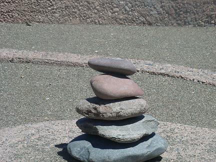
Description: Scene 2 of the Palo Verde Ruin (NRHP), a 20-acre, city-owned portion of what once was home to the largest Hohokam settlement along the New River, is the second landmark in Peoria, Arizona on the National Register of Historic Places. The rock formation is found in the Palo Verde Park section.
Title: P-Palo Cerde Ruins 2
Credit: Own work (Original text: I (Tony the Marine (talk)) created this work entirely by myself.)
Author: Tony the Marine (talk)
Usage Terms: Creative Commons Attribution-Share Alike 3.0
License: CC BY-SA 3.0
License Link: http://creativecommons.org/licenses/by-sa/3.0
Attribution Required?: Yes
Image usage
The following page links to this image:

All content from Kiddle encyclopedia articles (including the article images and facts) can be freely used under Attribution-ShareAlike license, unless stated otherwise.