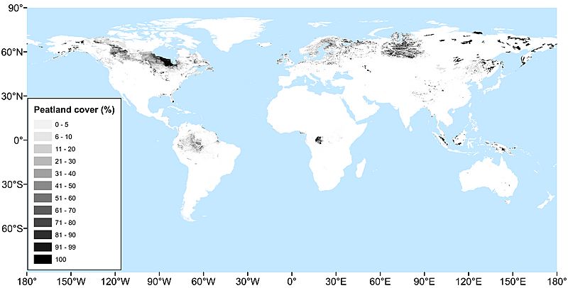
Image: PEATMAP

Description: PEATMAP is a GIS shapefile dataset shows a distribution of peatlands that covers the entire world. It was produced by combining the most high quality available peatland map from a wide variety of sources that describe peatland distributions at global, regional and national levels. The following sequence of comparisons to discriminate between overlapping data sources were used: (1) Relevance. The most important criterion was that source data are able to identify peatlands faithfully and to distinguish them from other land cover types, especially non-peat forming wetlands. (2) Spatial resolution. In areas where two or more overlapping data sources were indistinguishable in terms of their relevance to peatlands, the dataset with the finest spatial resolution was selected. (3) Age. In any areas where two or more overlapping datasets were indistinguishable based on both their apparent relevance to peatlands and their spatial resolution, the data product that had been most recently updated was selected. Recently updated products commonly contain much older source data, the period over which the latest revision source data were collected as the primary measure of the age of a dataset.
Title: PEATMAP
Credit: https://doi.org/10.5518/252
Author: Xu, Jiren and Morris, Paul J. and Liu, Junguo and Holden, Joseph
Usage Terms: Creative Commons Attribution-Share Alike 4.0
License: CC BY-SA 4.0
License Link: https://creativecommons.org/licenses/by-sa/4.0
Attribution Required?: Yes
Image usage
The following page links to this image:

