
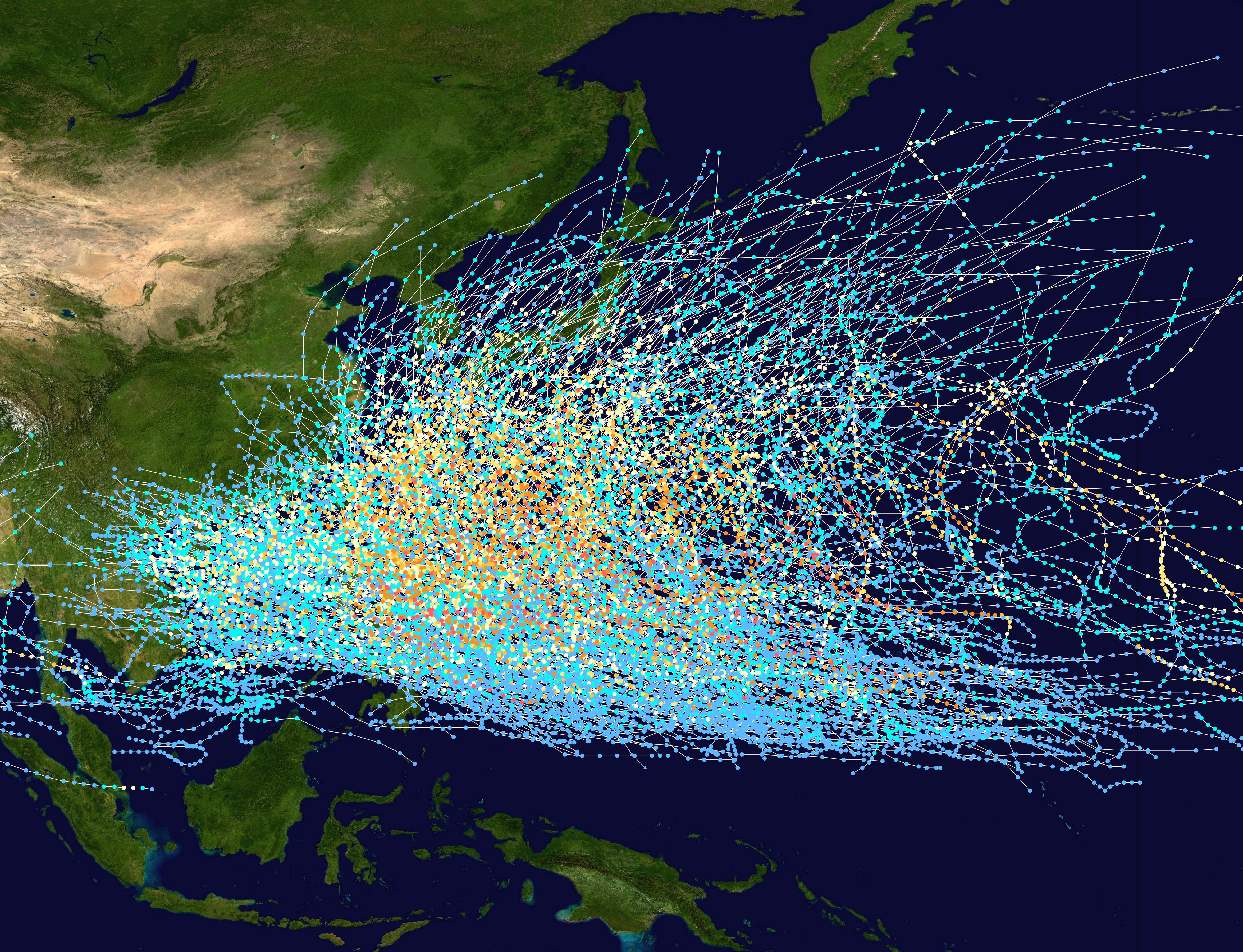
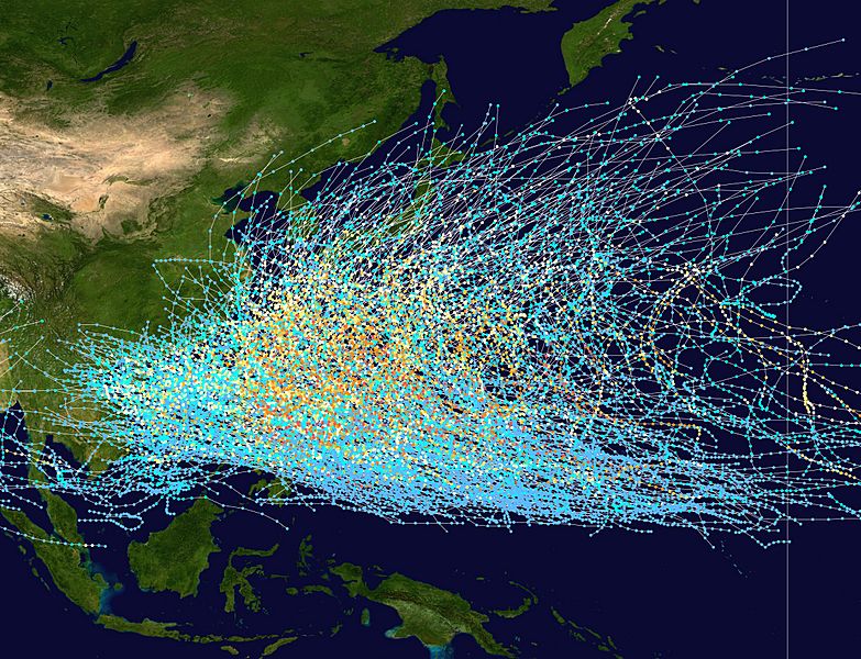
Image: Pacific typhoon tracks 1980-2005
Description: This trackmap shows the tracks of all tropical cyclones in the Northwest Pacific Ocean from 1980 to 2005. The International Date Line is marked on the map, this is the eastern boundary of the basin.. The points show the location of each storm at 6-hour intervals. The colour represents the storm's maximum sustained wind speeds as classified in the Saffir-Simpson Hurricane Scale (see below), and the shape of the data points represent the nature of the storm.
Title: Pacific typhoon tracks 1980-2005
Credit: Created using WikiProject Tropical cyclones/Tracks. The background image is from NASA [1]. The tracking data is from the Joint Typhoon Warning Center's best track database
Author: Nilfanion
Usage Terms: Public domain
License: Public domain
Attribution Required?: No
Image usage
The following 2 pages link to this image:
