
Image: Pakistan NWFP FATA South Waziristan

Size of this PNG preview of this SVG file: 558 × 600 pixels. Other resolution: 223 × 240 pixels.
Original image (SVG file, nominally 1,000 × 1,075 pixels, file size: 202 KB)
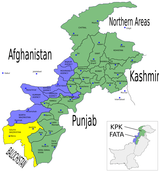
Description: Map showing the districts of the Federally Administered Tribal Areas (FATA) FATA and the North-West Frontier Province (NWFP) of Pakistan.
Title: Pakistan NWFP FATA South Waziristan
Credit: Pakistan_NWFP_FATA_areas_with_localisation_map.svg
Author: Pakistan_NWFP_FATA_areas_with_localisation_map.svg: *NWFP_FATA.svg: Pahari Sahib Provinces_and_territories_of_Pakistan_named_es.svg: Jarke derivative work: Pethrus (talk) derivative work: Guillaume70 (talk)
Usage Terms: Creative Commons Attribution-Share Alike 3.0
License: CC-BY-SA-3.0
License Link: http://creativecommons.org/licenses/by-sa/3.0/
Attribution Required?: Yes
Image usage
The following 2 pages link to this image:

All content from Kiddle encyclopedia articles (including the article images and facts) can be freely used under Attribution-ShareAlike license, unless stated otherwise.