
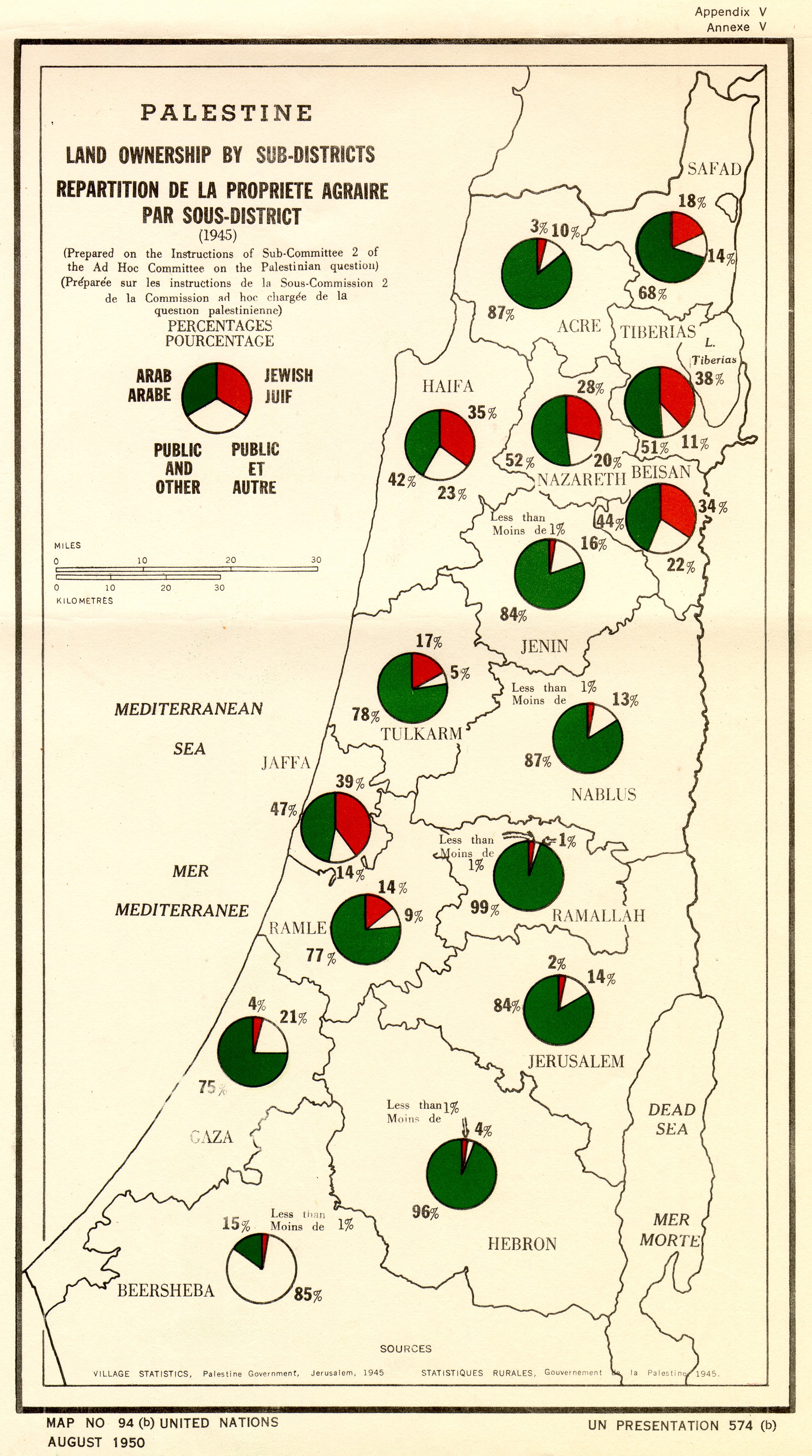
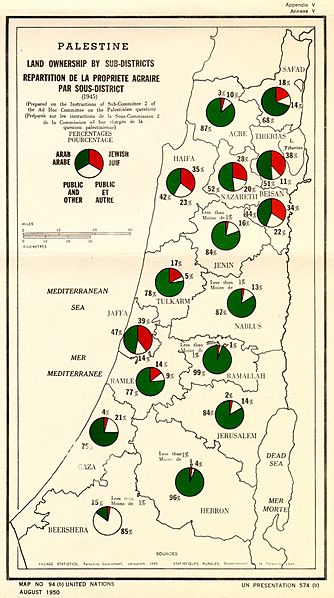
Image: Palestine Land ownership by sub-district (1945)
Size of this preview: 334 × 598 pixels. Other resolutions: 134 × 240 pixels | 2,038 × 3,651 pixels.
Original image (2,038 × 3,651 pixels, file size: 2 MB, MIME type: image/jpeg)
Description: Palestine: Land ownership by sub-district (1945) United Nations Map no. 94(b), August 1950
Title: Palestine Land ownership by sub-district (1945)
Credit: United Nations UNISPAL website
Author: United Nations
Usage Terms: Public domain
License: Public domain
Attribution Required?: No
Image usage
There are no pages that link to this image.

All content from Kiddle encyclopedia articles (including the article images and facts) can be freely used under Attribution-ShareAlike license, unless stated otherwise.
.jpg)