
Image: Papua new guinea provinces (numbers) 2012

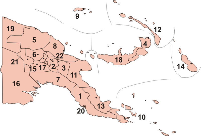
Description: Map of Provinces of Papua New Guinea, including new provinces (Hela & Jiwaka) officially inaugurated in May 2012. Central Chimbu (Simbu) Eastern Highlands East New Britain East Sepik Enga Gulf Madang Manus Milne Bay Morobe New Ireland Northern (Oro Province) Bougainville (North Solomons) Southern Highlands Western Province (Fly) Western Highlands West New Britain West Sepik (Sandaun) National Capital District Hela Jiwaka The composition of the new provinces is confirmed by the official results of the 2012 General Election. The boundaries of the component districts of Jiwaka / West Highland and Hela / Southern Highlands are taken from publications of the National Research Institute of Papua New Guinea.
Title: Papua new guinea provinces (numbers) 2012
Credit: Paint Shop Pro
Author: Keith Edkins at English Wikipedia
Usage Terms: Creative Commons Attribution-Share Alike 3.0
License: CC BY-SA 3.0
License Link: http://creativecommons.org/licenses/by-sa/3.0
Attribution Required?: Yes
Image usage
The following page links to this image:

_2012.png)