
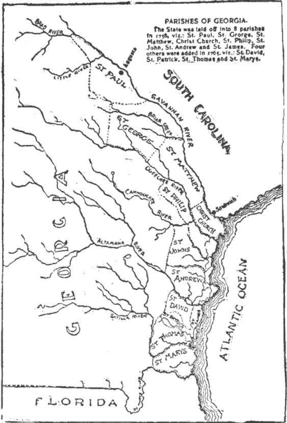
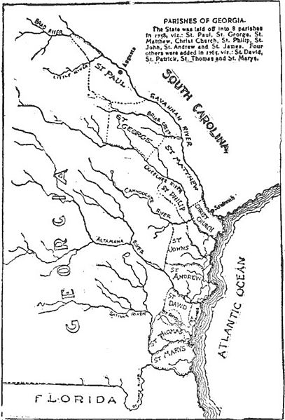
Image: Parishes of Georgia, 1765
Size of this preview: 407 × 599 pixels. Other resolutions: 163 × 240 pixels | 563 × 829 pixels.
Original image (563 × 829 pixels, file size: 85 KB, MIME type: image/jpeg)
Description: Map of the Province of Georgia as it appeared in 1765, including the parishes.
Title: Parishes of Georgia, 1765
Credit: https://books.google.com/books?id=3TEUY4QlCbcC The Story of Georgia and the Georgia People, 1732 to 1860, p. 52
Author: Book the image appears in written by George Gillman Smith. The author provided the following caption to accompany the image: "This excellent map was originally prepared under the direction of the University Publishing Co., who published Evans's History, and was transferred from their book to the pages of the Constitution, which has kindly furnished it to me."
Usage Terms: Public domain
License: Public domain
Attribution Required?: No
Image usage
The following page links to this image:

All content from Kiddle encyclopedia articles (including the article images and facts) can be freely used under Attribution-ShareAlike license, unless stated otherwise.