
Image: PawneeGrasslandInColorado
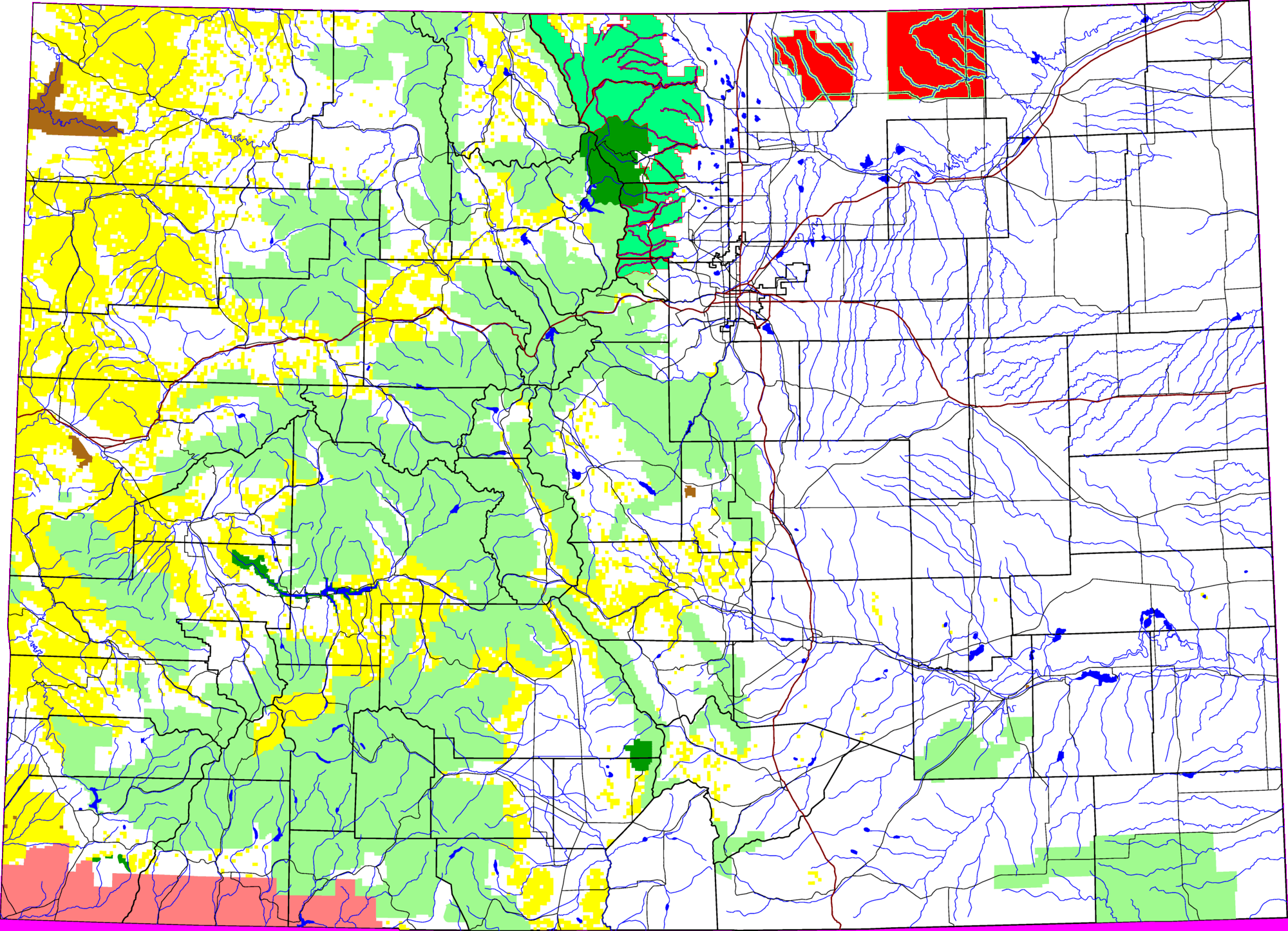
Description: A map of Colorado, with Pawnee National Grassland highlighted in red. The light green is other Forest Service land, yellow is BLM land, dark green is National Park, brown is National Monument or National Historic Site, pink is Indian reservation. The reddish lines are Interstate Highways. The map uses the azimuthal equidistant projection, centered on (-105.7167, 39.1333) (degrees latitude, longitude).
Title: PawneeGrasslandInColorado
Credit: David Benbennick made the original map, Image:Roosevelt National Forest location in Colorado.png with data from nationalatlas.gov; it was adapted for Pawnee National Grassland by User:Sethant
Author: Sethant at English Wikipedia
Usage Terms: Public domain
License: Public domain
Attribution Required?: No
Image usage
The following 2 pages link to this image:
