
Image: Pbiairportmap
Size of this preview: 602 × 600 pixels. Other resolutions: 241 × 240 pixels | 1,004 × 1,000 pixels.
Original image (1,004 × 1,000 pixels, file size: 295 KB, MIME type: image/png)
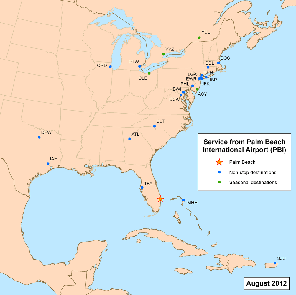
Description: This is a route map for Palm Beach International Airport as of February 2010. Map is an Azimuthal equidistant projection centered on the airport so straight lines from Palm Beach are along great circle routes.
Title: Pbiairportmap
Credit: self-made, data source, additional information verified on airline websites.
Author: Kmusser
Usage Terms: Creative Commons Attribution-Share Alike 3.0
License: CC BY-SA 3.0
License Link: http://creativecommons.org/licenses/by-sa/3.0
Attribution Required?: Yes
Image usage
The following page links to this image:

All content from Kiddle encyclopedia articles (including the article images and facts) can be freely used under Attribution-ShareAlike license, unless stated otherwise.