
Image: Penncolony

Size of this preview: 667 × 599 pixels. Other resolutions: 267 × 240 pixels | 700 × 629 pixels.
Original image (700 × 629 pixels, file size: 210 KB, MIME type: image/png)
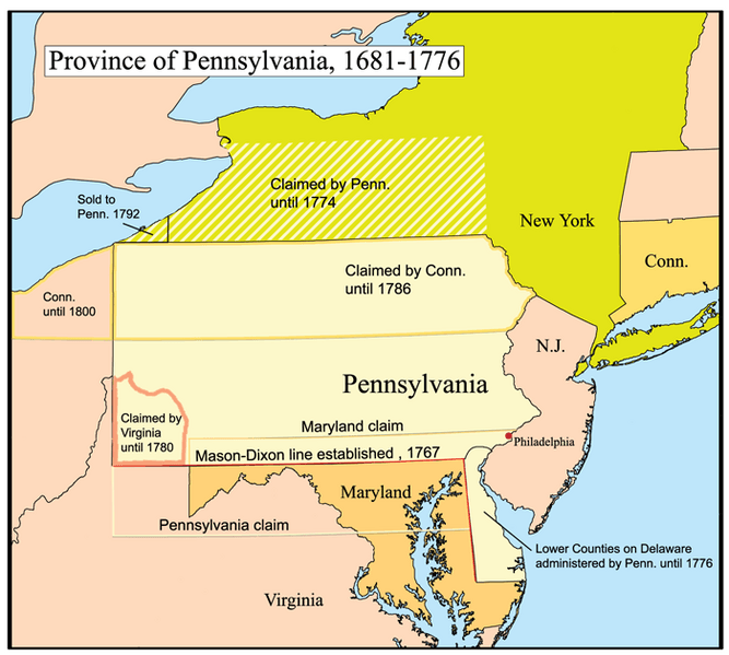
Description: This is a map of the Province of Pennsylvania that I made. Boundary disputes between colonies not involving Pennsylvania are not shown.
Title: Penncolony
Credit: No machine-readable source provided. Own work assumed (based on copyright claims).
Author: No machine-readable author provided. Kmusser assumed (based on copyright claims).
Usage Terms: Creative Commons Attribution-Share Alike 2.5
License: CC BY-SA 2.5
License Link: http://creativecommons.org/licenses/by-sa/2.5
Attribution Required?: Yes
Image usage
The following 7 pages link to this image:

All content from Kiddle encyclopedia articles (including the article images and facts) can be freely used under Attribution-ShareAlike license, unless stated otherwise.