
Image: PentlandFirthMap
No higher resolution available.
PentlandFirthMap.png (542 × 470 pixels, file size: 12 KB, MIME type: image/png)
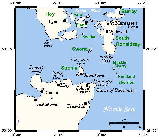
Description: A map of the Pentland Firth, northern Scotland, showing various towns and villages on the British mainland and in Orkney, as well as physical features, including islands in the Firth. This map's source is here, with the uploader's modifications, and the GMT homepage says that the tools are released under the GNU General Public License.
Title: PentlandFirthMap
Credit: Transferred from en.wikipedia to Commons.
Author: Kelisi at English Wikipedia
Usage Terms: Creative Commons Attribution-Share Alike 3.0 truetrue
License: CC-BY-SA-3.0
License Link: http://creativecommons.org/licenses/by-sa/3.0/
Attribution Required?: Yes
Image usage
The following 3 pages link to this image:

All content from Kiddle encyclopedia articles (including the article images and facts) can be freely used under Attribution-ShareAlike license, unless stated otherwise.