
Image: Peoria-Lake Pleasant Regional Park-Indian Mesa Ruins Marker
Size of this preview: 800 × 600 pixels. Other resolutions: 320 × 240 pixels | 960 × 720 pixels.
Original image (960 × 720 pixels, file size: 215 KB, MIME type: image/jpeg)
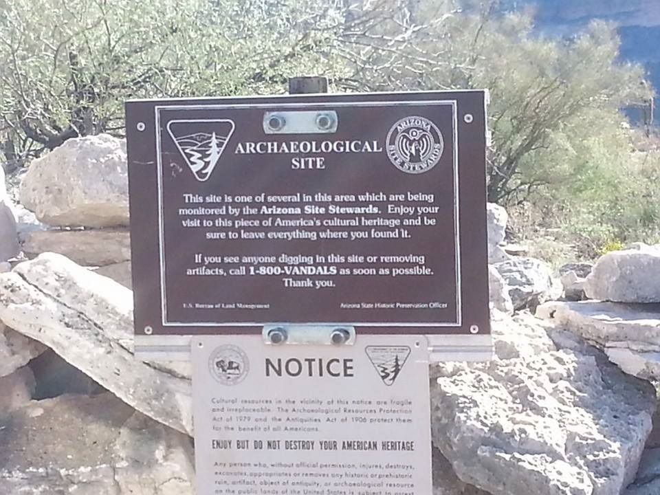
Description: U.S. Bureau of Land Management Marker on top of Indian Mesa where the 1000 year old ruins of a Hohokam village are located. Plaque:
Title: Peoria-Lake Pleasant Regional Park-Indian Mesa Ruins Marker
Credit: I (Tony the Marine (talk)) created this work entirely by myself.
Author: Tony the Marine (talk)
Usage Terms: Public domain
License: Public domain
Attribution Required?: No
Image usage
The following 3 pages link to this image:

All content from Kiddle encyclopedia articles (including the article images and facts) can be freely used under Attribution-ShareAlike license, unless stated otherwise.