
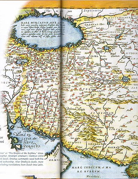
Image: Persian Empire Abraham Ortelius

Size of this preview: 461 × 599 pixels. Other resolutions: 184 × 240 pixels | 610 × 793 pixels.
Original image (610 × 793 pixels, file size: 340 KB, MIME type: image/jpeg)
Description: The Kingdom of Persian, this map was created by Dutch cartographer Abraham Ortelius, the first modern Atlas, and was printed from 1570 to 1624
Title: Persian Empire Abraham Ortelius
Credit: Fred Ramen, A historical atlas of Iran, published in 2003
Author: Abraham Ortelius
Usage Terms: Public domain
License: Public domain
Attribution Required?: No
Image usage
The following 2 pages link to this image:

All content from Kiddle encyclopedia articles (including the article images and facts) can be freely used under Attribution-ShareAlike license, unless stated otherwise.