
Image: PigWar-boundaries
Size of this preview: 742 × 600 pixels. Other resolutions: 297 × 240 pixels | 1,058 × 855 pixels.
Original image (1,058 × 855 pixels, file size: 637 KB, MIME type: image/png)
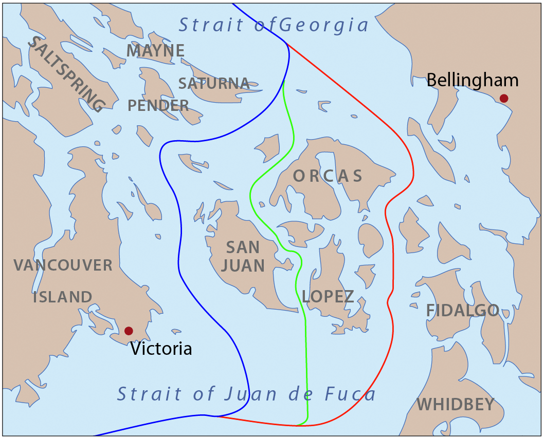
Description: This is a map of the proposed boundaries between the United States and Canada around the San Juan Islands, for use in describing the Pig War. I, Pfly, made it with ArcGIS, Adobe Illustrator, and Adobe Photoshop.
Title: PigWar-boundaries
Credit: self-made, information one boundaries from Hayes, Derek, Historical Atlas of the Pacific Northwest.
Author: Pfly
Usage Terms: Creative Commons Attribution-Share Alike 3.0
License: CC BY-SA 3.0
License Link: https://creativecommons.org/licenses/by-sa/3.0
Attribution Required?: Yes
Image usage
The following 2 pages link to this image:

All content from Kiddle encyclopedia articles (including the article images and facts) can be freely used under Attribution-ShareAlike license, unless stated otherwise.