
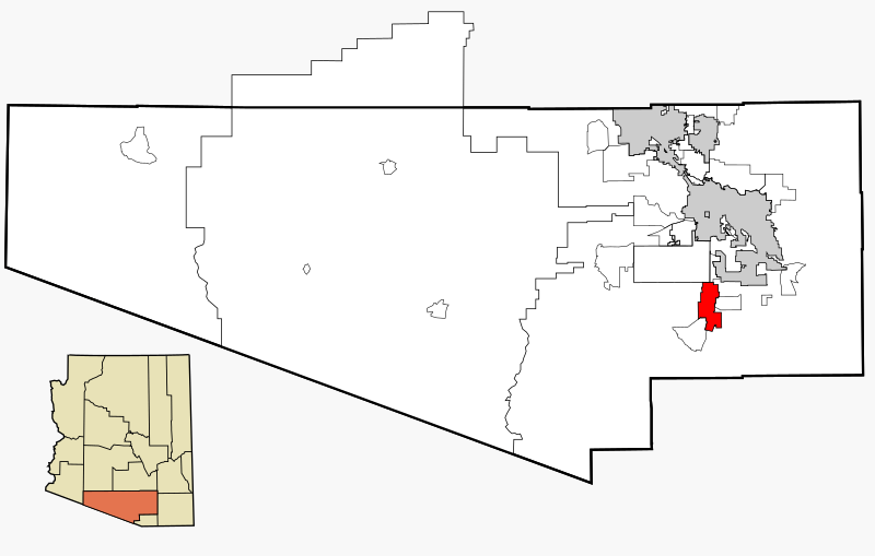
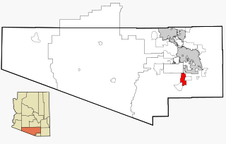
Image: Pima County Incorporated and Unincorporated areas Sahuarita highlighted

Description: This map shows the incorporated areas and unincorporated areas in Pima County, Arizona. Incorporated cities are shown in gray and data for their borders and locations are based on the 2000/2030 PAG Transportation Analysis Zone Map. The Town of Sahuarita is highlighted in red. Information for unincorporated locations and borders are based on the Census 2000 Pima County Tract Outline Index Map (PDF). I created this map in w:Inkscape.
Title: Pima County Incorporated and Unincorporated areas Sahuarita highlighted
Credit: My own work, based on public domain information
Author: Ixnayonthetimmay
Permission: Copyleft-type licensing. See below.
Usage Terms: Creative Commons Attribution-Share Alike 3.0
License: CC-BY-SA-3.0
License Link: http://creativecommons.org/licenses/by-sa/3.0/
Attribution Required?: Yes
Image usage
There are no pages that link to this image.
