
Image: Pinal County Arizona Incorporated and Unincorporated areas San Tan Valley highlighted

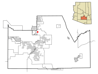
Description: This map shows the incorporated areas and unincorporated areas in Pinal County, Arizona. San Tan Valley is highlighted in red. Other incorporated cities are shown in gray, planning area borders for these cities and Indian reservation borders are shown as solid black lines. Map data is based on the following files as noted, all of which are .pdf files: *Pinal County 2008 Comprehensive Plan Amendments (.pdf) - For determining incorporated and Indian reservation boundaries. *CAAG Pinal Planning Commissioners Presentation (.pdf) - For determining planning area boundaries in Pinal County. *CAAG Population Estimates for Pinal County Places (.pdf) - For determining boundaries of unincorporated areas in Pinal County. Additional data for cities shown are based on individual files from each city's Website. (Please view the category page for links to these files.) I created this map in Inkscape. Please Note: This file replaces Image:Pinal County Incorporated areas San Tan highlighted.svg, which is now obsolete!
Title: Pinal County Arizona Incorporated and Unincorporated areas San Tan Valley highlighted
Credit: My own work, based on public domain information
Author: Ixnayonthetimmay
Permission: Public Domain
Usage Terms: Public domain
License: Public domain
Attribution Required?: No
Image usage
The following page links to this image:
