
Image: Pinckney's Treaty line 1795
Size of this preview: 711 × 599 pixels. Other resolutions: 285 × 240 pixels | 1,164 × 981 pixels.
Original image (1,164 × 981 pixels, file size: 707 KB, MIME type: image/png)
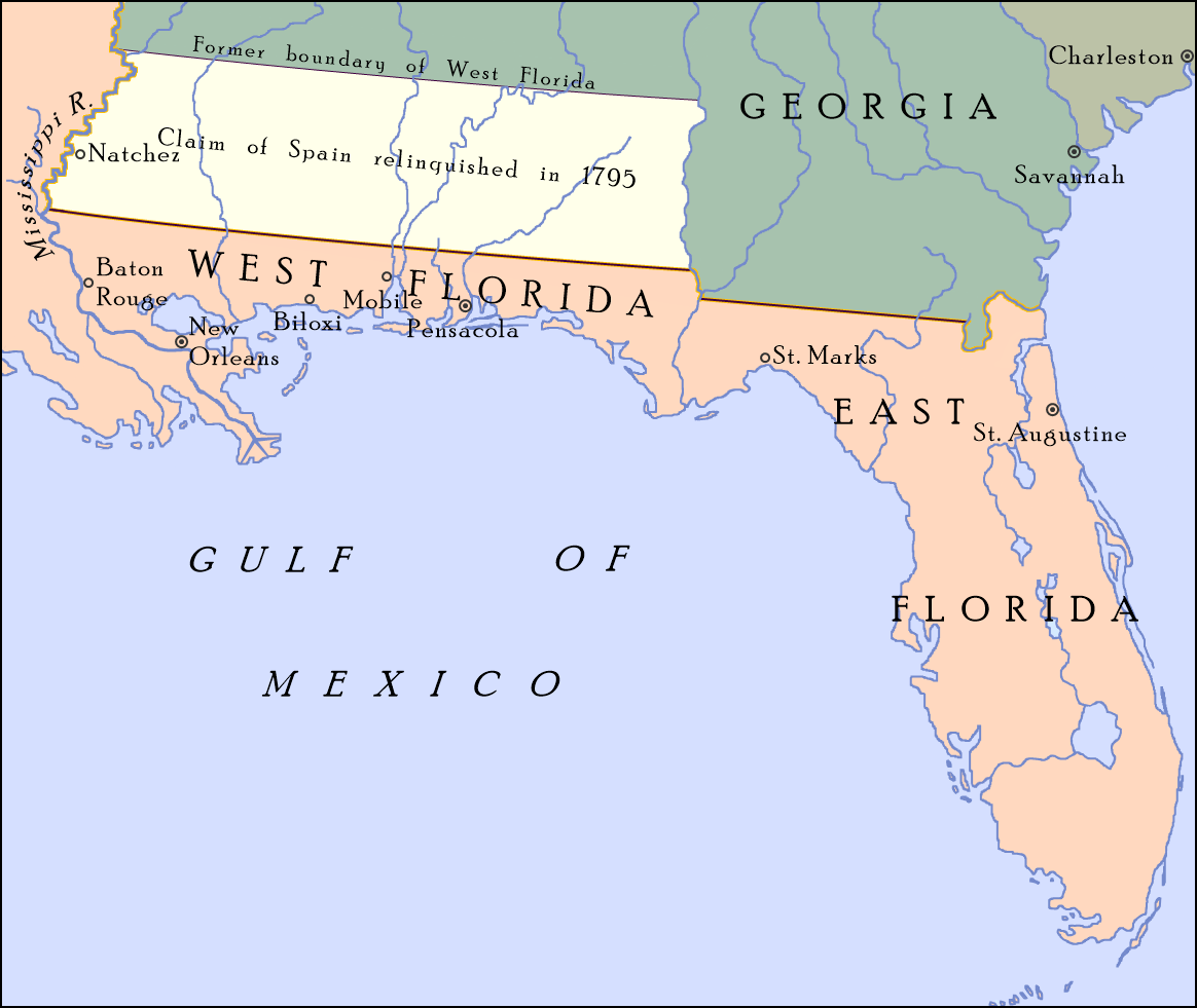
Description: Map showing the boundary between the United States and Spanish Florida as set by "Pinckney's Treaty"—signed on October 27, 1795 and became effective on August 3, 1796—at 31°N; also shown is the portion of Spanish West Florida between 31°N and 32° 22′, which Spain relinquished its claim to in the treaty. On April 7, 1798, Congress organized the region as the Mississippi Territory.[1]
Author: Drdpw
Usage Terms: Creative Commons Attribution-Share Alike 3.0
License: CC-BY-SA-3.0
License Link: http://creativecommons.org/licenses/by-sa/3.0/
Attribution Required?: Yes
Image usage
The following 3 pages link to this image:

All content from Kiddle encyclopedia articles (including the article images and facts) can be freely used under Attribution-ShareAlike license, unless stated otherwise.