
Image: Piri Reis map interpretation RG

Size of this preview: 744 × 600 pixels. Other resolutions: 298 × 240 pixels | 800 × 645 pixels.
Original image (800 × 645 pixels, file size: 187 KB, MIME type: image/jpeg)
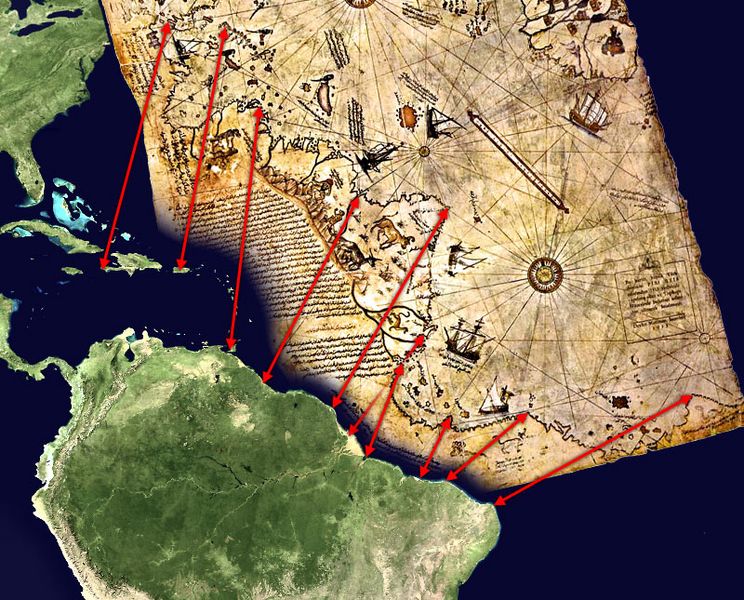
Description: Possible interpretation of the Piri Reis map. Middle and south america on the left, north africa in the upper right, south atlantic ocean in the middle. An alternate (and more likely) interpretation of those ancient map can be found here: File:Piri Reis map interpretation.jpg
Title: Piri Reis map interpretation RG
Credit: Own work, based on de:Datei:Karte des piri reis.jpg and File:Whole world - land and oceans.jpg. Both sources are public domain.
Author: TMg, based on an image by Segantini.
Usage Terms: Public domain
License: Public domain
Attribution Required?: No
Image usage
There are no pages that link to this image.

All content from Kiddle encyclopedia articles (including the article images and facts) can be freely used under Attribution-ShareAlike license, unless stated otherwise.