
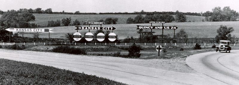
Image: Pittsfield, IL Y (1926)

Size of this preview: 800 × 286 pixels. Other resolutions: 320 × 114 pixels | 900 × 322 pixels.
Original image (900 × 322 pixels, file size: 93 KB, MIME type: image/jpeg)
Description: Looking west at the junction of then-new U.S. Route 36 (east, northwest) and an existing route to Kansas City, Missouri (southwest). Modern-day junction of Illinois Route 106 (east, northwest) and U.S. Route 54 (southwest)
Title: Pittsfield, IL Y (1926)
Credit: http://ppoo.org/IL.html
Author: Unknown
Permission: Public domain
Usage Terms: Public domain in the United States
License: PD-US
License Link: //en.wikipedia.org/wiki/File:Pittsfield,_IL_Y_(1926).jpg
Image usage
The following page links to this image:

All content from Kiddle encyclopedia articles (including the article images and facts) can be freely used under Attribution-ShareAlike license, unless stated otherwise.
.jpg)