
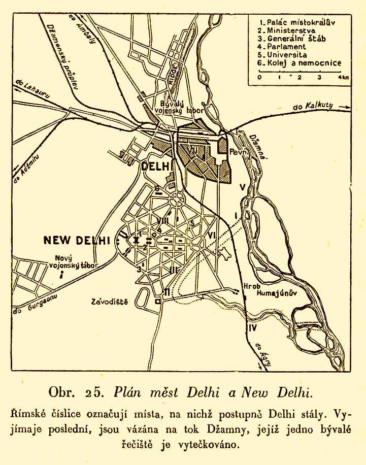
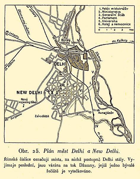
Image: Plán měst Delhi a New Delhi
Size of this preview: 472 × 600 pixels. Other resolutions: 189 × 240 pixels | 721 × 916 pixels.
Original image (721 × 916 pixels, file size: 152 KB, MIME type: image/jpeg)
Description: Map of Delhi and New Delhi after the First World War. The descriptions are in Czech.
Title: Plán měst Delhi a New Delhi
Credit: Book Zeměpis světa, díl devátý, Monsunová Asie, část druhá, Přední a Zadní Indie, Indické souostroví. Published by publishing house Aventinum in Prague.
Author: Unknown
Usage Terms: Public domain
License: Public domain
Attribution Required?: No
Image usage
The following page links to this image:

All content from Kiddle encyclopedia articles (including the article images and facts) can be freely used under Attribution-ShareAlike license, unless stated otherwise.