
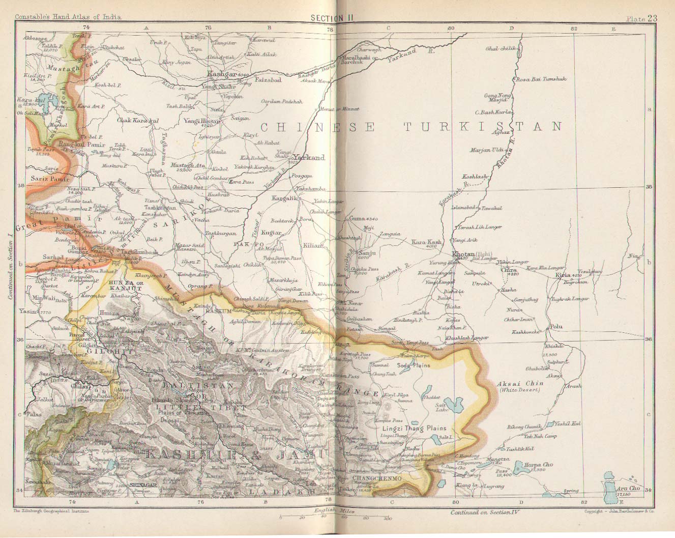
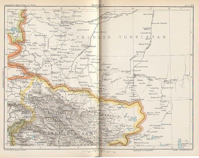
Image: Plate 23. Sect. II- Chinese Turkistan, Kashmir & Jamu of maps of Constables 1893 hand atlas
Description: Section 1Section 2Section 3Section 4Section 5 (*Karachi*)Section 6 (*Delhi*)Section 7 (*Lucknow*)Section 8 (*Calcutta*)Section 9Section 10 (*Bombay*)Section 11Section 12Section 13 (*Madras*)Section 14MAPS FROM CONSTABLE'S 1893 HAND ATLAS -- see also the accompanying *INDEX OF PLACE NAMES*Source of all these maps: http://homepages.rootsweb.com/~poyntz/India/maps.html#area(downloaded Oct. 2005)# Plate 22. Sect. I: Afghan Turkistan, Bokhara, Hindu Kush and Kafiristan# Plate 23. Sect. II: Chinese Turkistan, Kashmir & Jamu# Plate 24. Sect. III: Afghan Frontier, SE Afghanistan and west Punjab# Plate 25. Sect. IV: East Punjab and Kashmir# Plate 26. Sect. V: Rajputana west, Sind, Cutch and Gujarat# Plate 27. Sect. VI: Rajputana east# Plate 28. Sect. VII: NW Provinces, west Nepal, Oudh# Plate 29. Sect. VIII: Bengal, Nepal, Sikkim, Bhutan and west Assam# Plate 30. Sect. IX: Upper Burma, Assam and Chittagong# Plate 31. Sect. X: Bombay, Aden and Socotra# Plate 32. Sect. XI: Central Provinces# Plate 33. Sect. XII: Lower Burma# Plate 34. Sect. XIII: Madras, Mysore and Goa# Plate 35. Sect. XIV: Travancore, Trichinopoli and Ceylon*Bombay map**Calcutta map**Delhi map**Karachi map**Lucknow map**Madras map*
Title: Plate 23. Sect. II- Chinese Turkistan, Kashmir & Jamu of maps of Constables 1893 hand atlas
Credit: http://www.columbia.edu/itc/mealac/pritchett/00maplinks/colonial/constable1893/constable1893.html
Author: Constable
Usage Terms: Public domain
License: Public domain
Attribution Required?: No
Image usage
The following 2 pages link to this image:
