
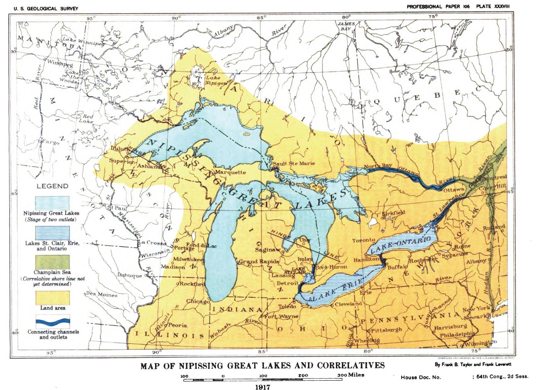
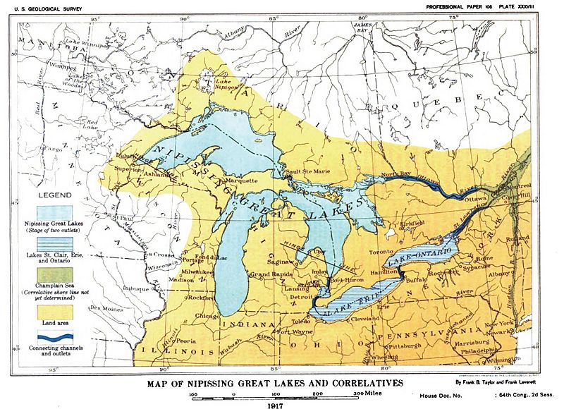
Image: Plate 27 - Glacial Lake Nipissing and its Correlatives (USGS 1915) or 1917 Nipissing Great Lakes & correletives
Size of this preview: 800 × 580 pixels. Other resolutions: 320 × 232 pixels | 1,797 × 1,302 pixels.
Original image (1,797 × 1,302 pixels, file size: 370 KB, MIME type: image/jpeg)
Description: Map of Nipissing Great Lakes from the U.S. Geological Survey monograph of 1915.
Title: Plate 27 - Glacial Lake Nipissing and its Correlatives (USGS 1915) or 1917 Nipissing Great Lakes & correletives
Credit: US Geological Survey: Plate 27 - Glacial Lake Nipissing and its Correlatives (USGS 1915) or 1917 Nipissing Great Lakes & correletives
Author: Frank Leverett
Usage Terms: Public domain
License: Public domain
Attribution Required?: No
Image usage
The following page links to this image:

All content from Kiddle encyclopedia articles (including the article images and facts) can be freely used under Attribution-ShareAlike license, unless stated otherwise.
_or_1917_Nipissing_Great_Lakes_&_correletives.JPG)