
Image: Platslc
Size of this preview: 378 × 599 pixels. Other resolutions: 151 × 240 pixels | 579 × 917 pixels.
Original image (579 × 917 pixels, file size: 582 KB, MIME type: image/jpeg)
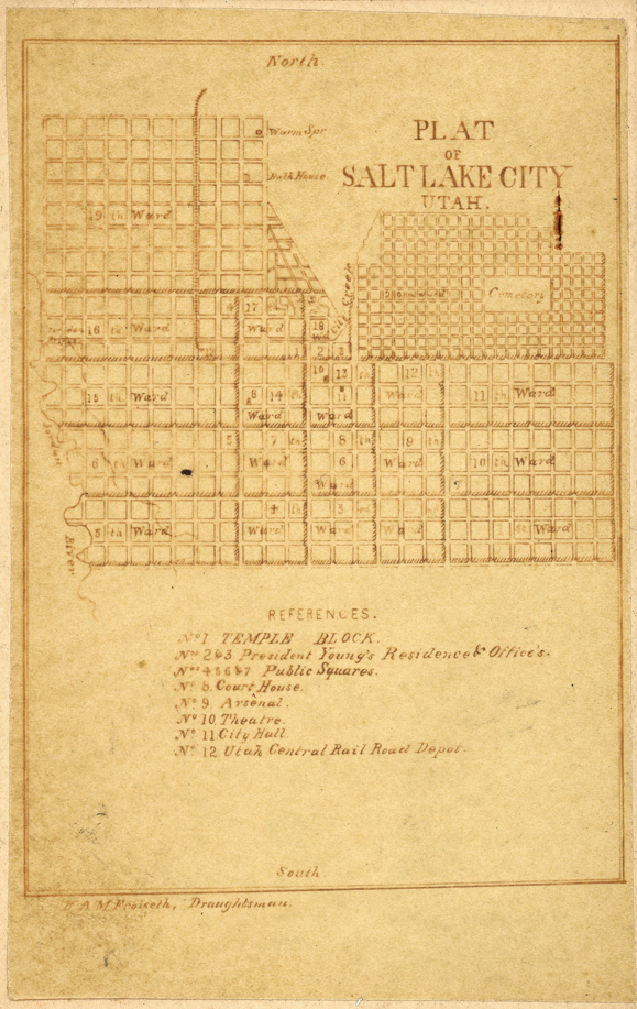
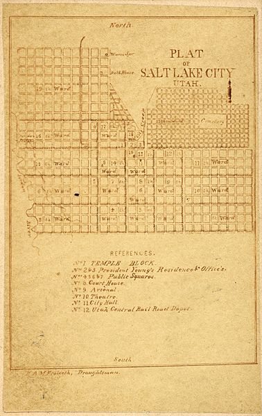
Description: Photograph of a street map of Salt Lake City called Plat of Salt Lake City, Utah. A street map, showing the blocks and divisions of blocks in the downtown Salt Lake City area produced in the late 1860's by E. Martin, Photographer, East Temple Street, Salt Lake City, Utah Territory.
Title: Platslc
Credit: From Library of Congress [1]. Courtesy Special Collections, Harold B. Lee Library, Brigham Young University, Provo, UT 84602.
Author: E. Martin, Photographer, East Temple Street, Salt Lake City, Utah Territory.
Usage Terms: Public domain
License: Public domain
Attribution Required?: No
Image usage
The following 2 pages link to this image:

All content from Kiddle encyclopedia articles (including the article images and facts) can be freely used under Attribution-ShareAlike license, unless stated otherwise.