
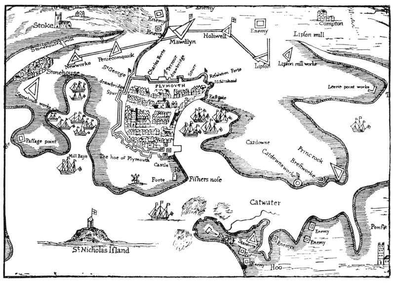
Image: Plymouth siege map 1643

Size of this preview: 800 × 573 pixels. Other resolutions: 320 × 229 pixels | 4,075 × 2,921 pixels.
Original image (4,075 × 2,921 pixels, file size: 1.21 MB, MIME type: image/gif)
Description: Part of "A True Mapp and Description of the Towne of Plymouth and the Fortifications thereof at the last siege, A. 1643"
Title: Plymouth siege map 1643
Credit: A 17th century map, reproduced in Bracken: A History of Plymouth, 1931, opp. p126.
Author: Original author unknown, fl 17th century. Scanned by me 2008-07-05.
Usage Terms: Public domain
License: Public domain
Attribution Required?: No
Image usage
The following 4 pages link to this image:

All content from Kiddle encyclopedia articles (including the article images and facts) can be freely used under Attribution-ShareAlike license, unless stated otherwise.