
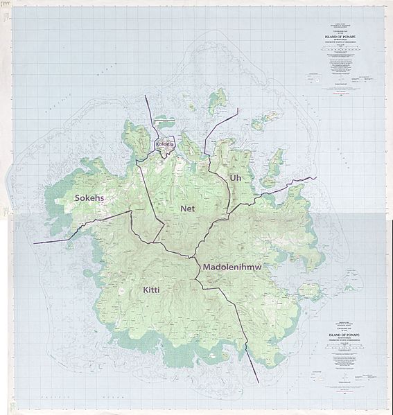
Image: Pohnpei Island municipalities

Description: Pohnpei Island with municipality boundaries, Micronesia, Pacific Ocean, stitching of 4 maps
Title: Pohnpei Island municipalities
Credit: http://www.lib.utexas.edu/maps/topo/pacific_islands/txu-oclc-17153631-ponape-north-b.jpg http://www.lib.utexas.edu/maps/topo/pacific_islands/txu-oclc-17153631-ponape-north-a.jpg http://www.lib.utexas.edu/maps/topo/pacific_islands/txu-oclc-17153631-ponape-south-a.jpg http://www.lib.utexas.edu/maps/topo/pacific_islands/txu-oclc-17153631-ponape-south-b.jpg
Author: USGS, stitching by NordNordWest
Permission: This image is in the public domain in the United States because it only contains materials that originally came from the United States Geological Survey, an agency of the United States Department of the Interior. For more information, see the official USGS copyright policy. Български | Català | Čeština | Deutsch | English | Español | Eesti | فارسی | Suomi | Français | Galego | Italiano | 日本語 | 한국어 | Македонски | മലയാളം | Nederlands | Polski | Português | Русский | Sicilianu | Türkçe | 中文 | 中文(简体) | +/−
Usage Terms: Public domain
License: Public domain
Attribution Required?: No
Image usage
The following page links to this image:
