
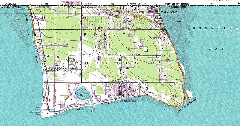
Image: Point Roberts USGS map cropped

Size of this preview: 800 × 421 pixels. Other resolutions: 320 × 168 pixels | 1,315 × 692 pixels.
Original image (1,315 × 692 pixels, file size: 269 KB, MIME type: image/jpeg)
Description: Map of Point Roberts, Washington. The area lies south of 49° northern latitude, thus is part of the United States, but is not connected to the US mainland.
Title: Point Roberts USGS map cropped
Credit: Point Roberts Quadrangle 7.5 minute series (topographic), available at http://www.usgs.gov/pubprod/
Author: United States Geological Survey
Usage Terms: Public domain
License: Public domain
Attribution Required?: No
Image usage
The following page links to this image:

All content from Kiddle encyclopedia articles (including the article images and facts) can be freely used under Attribution-ShareAlike license, unless stated otherwise.