
Image: Political map of India EN

Size of this PNG preview of this SVG file: 511 × 599 pixels. Other resolution: 205 × 240 pixels.
Original image (SVG file, nominally 1,594 × 1,868 pixels, file size: 299 KB)
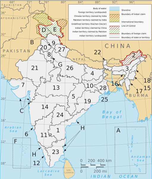
Description: Numbered map of India's states, union territories, and international territorial disputes. Based on Planemad's w:File:India map en.svg and Nichalp's w:File:India-states-numbered.svg. Same references.
Title: Political map of India EN
Credit: Own work, adapted from Planemad's w:File:India map en.svg and Nichalp's w:File:India-states-numbered.svg.
Author: Saravask
Usage Terms: Creative Commons Attribution-Share Alike 3.0
License: CC BY-SA 3.0
License Link: https://creativecommons.org/licenses/by-sa/3.0
Attribution Required?: Yes
Image usage
The following 2 pages link to this image:

All content from Kiddle encyclopedia articles (including the article images and facts) can be freely used under Attribution-ShareAlike license, unless stated otherwise.