
Image: Pondicherry map
Size of this preview: 582 × 600 pixels. Other resolutions: 233 × 240 pixels | 2,284 × 2,354 pixels.
Original image (2,284 × 2,354 pixels, file size: 1.6 MB, MIME type: image/png)
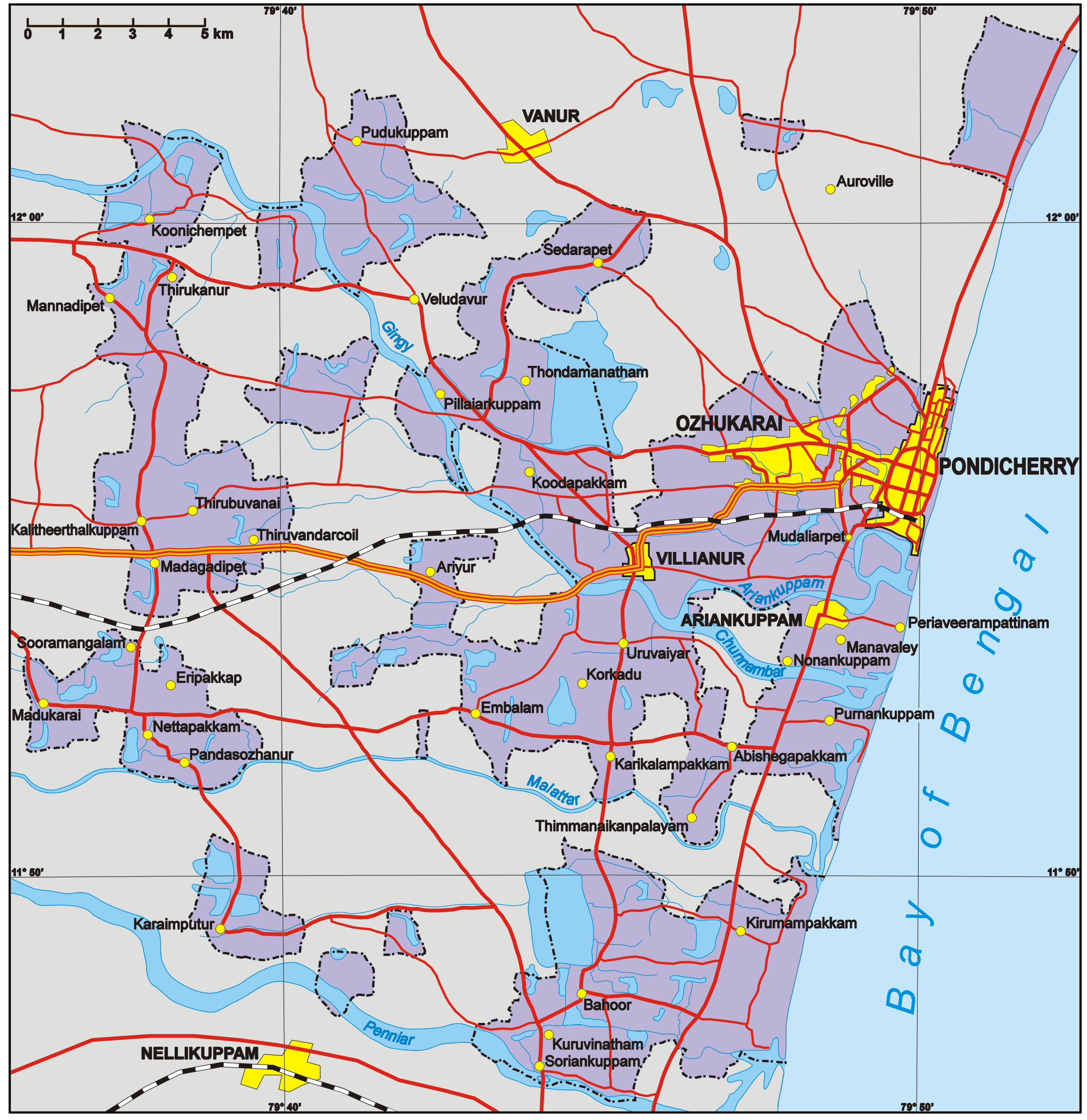
Description: Map of the Puducherry District (areas in purple only), Union Territory of Puducherry, India. Areas in grey are part of the state of Tamil Nadu. The fragmented configuration is a legacy of colonial days when the Territoire de Pondichéry, now Puducherry District, was part of French India.
Title: Pondicherry map
Credit: No machine-readable source provided. Own work assumed (based on copyright claims).
Author: No machine-readable author provided. Aotearoa assumed (based on copyright claims).
Usage Terms: Creative Commons Attribution-Share Alike 3.0
License: CC-BY-SA-3.0
License Link: http://creativecommons.org/licenses/by-sa/3.0/
Attribution Required?: Yes
Image usage
The following page links to this image:

All content from Kiddle encyclopedia articles (including the article images and facts) can be freely used under Attribution-ShareAlike license, unless stated otherwise.