
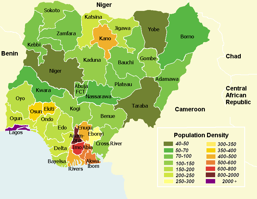
Image: Population density map of Nigerian states - English
Size of this preview: 773 × 599 pixels. Other resolutions: 310 × 240 pixels | 823 × 638 pixels.
Original image (823 × 638 pixels, file size: 44 KB, MIME type: image/png)
Description: Nigerian states by population density (English legend). Population densities are listed in population/km².
Title: Population density map of Nigerian states - English
Credit: english version of map from german wikipedia [1]
Author: Marcel Krüger
Usage Terms: Creative Commons Attribution-Share Alike 3.0
License: CC-BY-SA-3.0
License Link: http://creativecommons.org/licenses/by-sa/3.0/
Attribution Required?: Yes
Image usage
The following page links to this image:

All content from Kiddle encyclopedia articles (including the article images and facts) can be freely used under Attribution-ShareAlike license, unless stated otherwise.