
Image: Port Phillip 10,000
No higher resolution available.
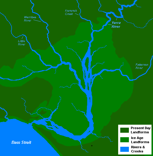
Port_Phillip_10,000.PNG (514 × 523 pixels, file size: 20 KB, MIME type: image/png)
Description: A very basic map of the port phillip plains approximately 10-12 thousand years ago, prior to sea level rise that filled the area of land now known as Port Phillip, and the course of the Yarra River as it emptied into Bass Strait. More exact details regarding the course of the Yarra River in the port phillip plains are needed.
Title: Port Phillip 10,000
Credit: Own work
Author: Nick carson at English Wikipedia
Usage Terms: Public domain
License: Public domain
Attribution Required?: No
Image usage
The following 2 pages link to this image:

All content from Kiddle encyclopedia articles (including the article images and facts) can be freely used under Attribution-ShareAlike license, unless stated otherwise.