
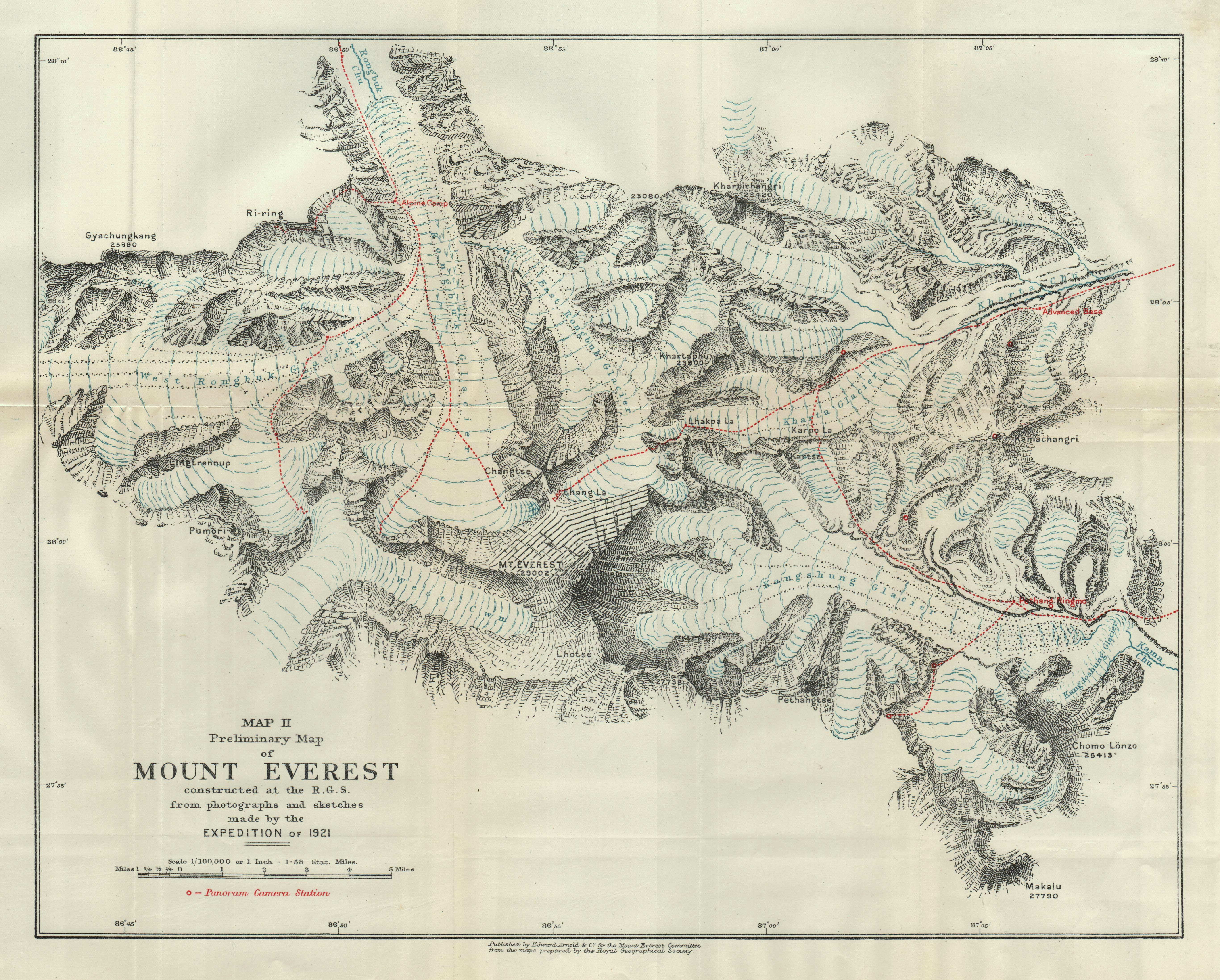
Image: Preliminary Map of Mount Everest. Howard-Bury, 1922
Size of this preview: 747 × 600 pixels. Other resolutions: 299 × 240 pixels | 5,464 × 4,388 pixels.
Original image (5,464 × 4,388 pixels, file size: 2.6 MB, MIME type: image/jpeg)
Description: Map II from Howard-Bury, C. K. (1922). Mount Everest the Reconnaissance, 1921 (1 ed.). New York, Longman & Green
Title: Preliminary Map of Mount Everest. Howard-Bury, 1922
Credit: Original publication: New York Immediate source: http://pahar.in/mountains/1921-preliminary-map-of-mount-everest-by-rgs-jpg/
Author: Drawn by H. F. Milne, chief cartographer of Royal Geographical Society from surveys by (Milne: unknown, Wheeler: April 18, 1890 – March 19, 1962)
Usage Terms: Public domain
License: Public domain
Attribution Required?: No
Image usage
The following page links to this image:

All content from Kiddle encyclopedia articles (including the article images and facts) can be freely used under Attribution-ShareAlike license, unless stated otherwise.