
Image: Prince Edward Island map 1775
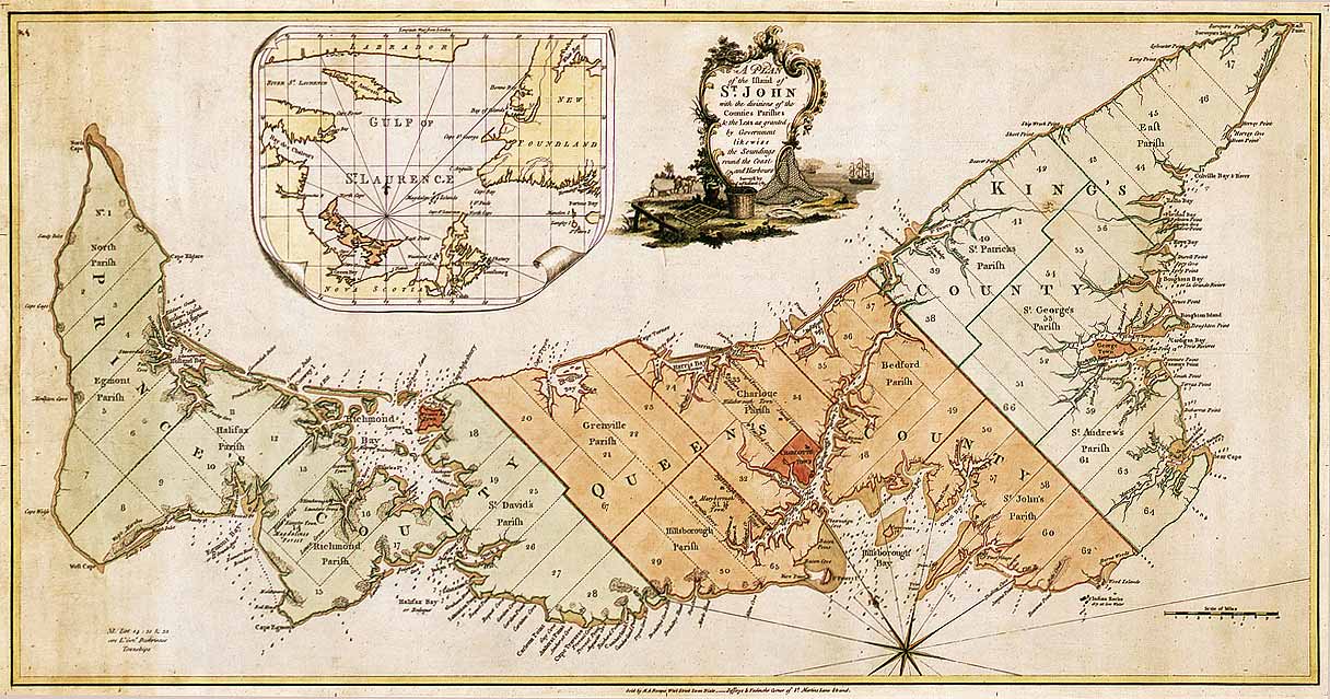
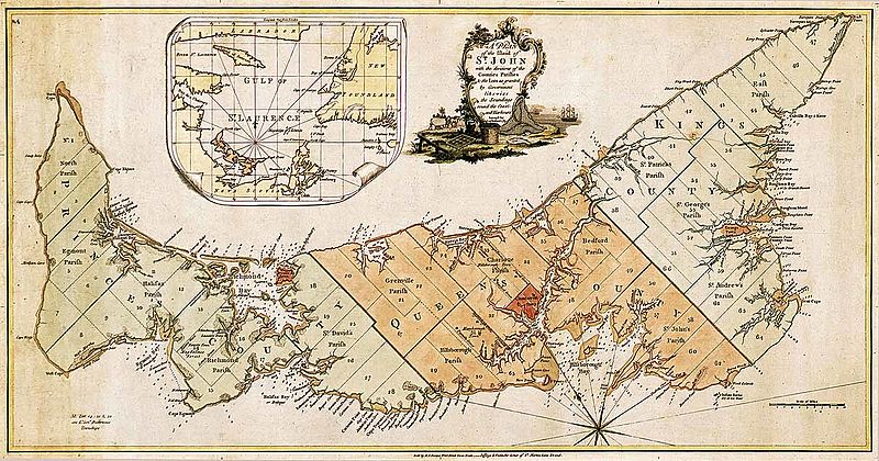
Description: Map of Prince Edward Island in 1775. Titled: "A plan of the island of St. John with the divisions of the counties parishes & the lots as granted by government likewise the soundings round the coast and harbours. Surveyed by Capt. Holland. 1775."The island was the first of the new English colonies for which a general survey was conducted. Samuel Holland was in charge of the survey. Known as Île Saint-Jean at the time of the French, and later Saint John Island, it did not take its present name until 1799. This very detailed plan shows the projected counties, parishes, townships and lots on the island following the expulsion of the Acadians in 1758. Samuel Holland, surveyor general of the province of Quebec, surveyed the island in the fall of 1764. He identified the location of the capital and named it Charlottetown. The counties and townships are listed with their sizes in acres. Inset map of the Gulf of St. Lawrence. Decorative cartouche showing farming and fishing sceneries.
Title: Prince Edward Island map 1775
Credit: This image is available from Library and Archives Canada under the reproduction reference number R3908-8-5-E (formerly NMC 23350) and under the MIKAN ID number 3705866 This tag does not indicate the copyright status of the attached work. A normal copyright tag is still required. See Commons:Licensing for more information. Library and Archives Canada does not allow free use of its copyrighted works. See Category:Images from Library and Archives Canada.
Author: Samuel Holland
Usage Terms: Public domain
License: Public domain
Attribution Required?: No
Image usage
The following image is a duplicate of this image (more details):
The following page links to this image:
