
Image: Proposed Dunstable and Luton Northern Bypass
No higher resolution available.
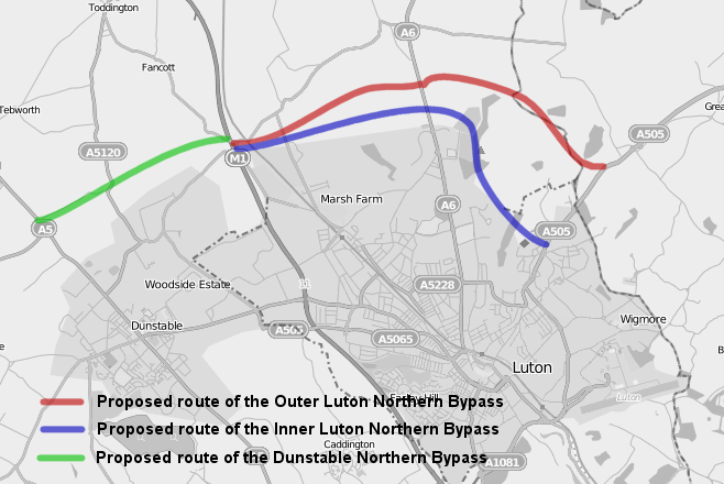
Proposed_Dunstable_and_Luton_Northern_Bypass.png (658 × 440 pixels, file size: 125 KB, MIME type: image/png)
Description: A map displaying the proposed Dunstable Northern Bypass, in green and the proposed inner route, in blue, and outer route, in red, of the Luton Northern Bypass. Overlaid on OpenStreetMap data.
Title: Proposed Dunstable and Luton Northern Bypass
Credit: Own work over OpenStreetMap data.
Author: user:HelioSmith, OpenStreetMap
Usage Terms: Creative Commons Attribution-Share Alike 3.0
License: CC BY-SA 3.0
License Link: http://creativecommons.org/licenses/by-sa/3.0
Attribution Required?: Yes
Image usage
The following 2 pages link to this image:

All content from Kiddle encyclopedia articles (including the article images and facts) can be freely used under Attribution-ShareAlike license, unless stated otherwise.