
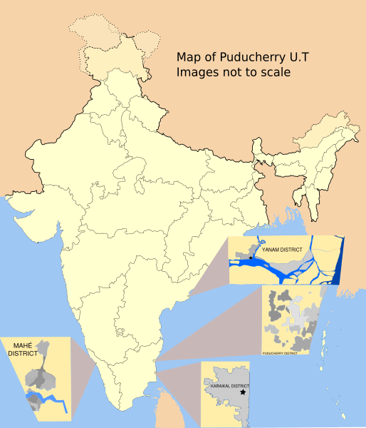
Image: Puducherry Map

Size of this PNG preview of this SVG file: 514 × 600 pixels. Other resolution: 206 × 240 pixels.
Original image (SVG file, nominally 1,486 × 1,734 pixels, file size: 784 KB)
Description: Map showing the four districts of the Union Territory of Puducherry, India. Uses File:India-locator-map-blank.svg as a base. District maps recreated from the following raster images File:മയ്യഴി.png - vectorised File:Karikal 1-126720 58N-NE 1920s.jpg - Hand traced File:Manavely.png - vectorised File:Yanaon_1932.jpg - Hand traced
Title: Puducherry Map
Credit: Own work
Author: RaviC
Usage Terms: Creative Commons Attribution-Share Alike 3.0
License: CC BY-SA 3.0
License Link: http://creativecommons.org/licenses/by-sa/3.0
Attribution Required?: Yes
Image usage
The following 3 pages link to this image:

All content from Kiddle encyclopedia articles (including the article images and facts) can be freely used under Attribution-ShareAlike license, unless stated otherwise.