
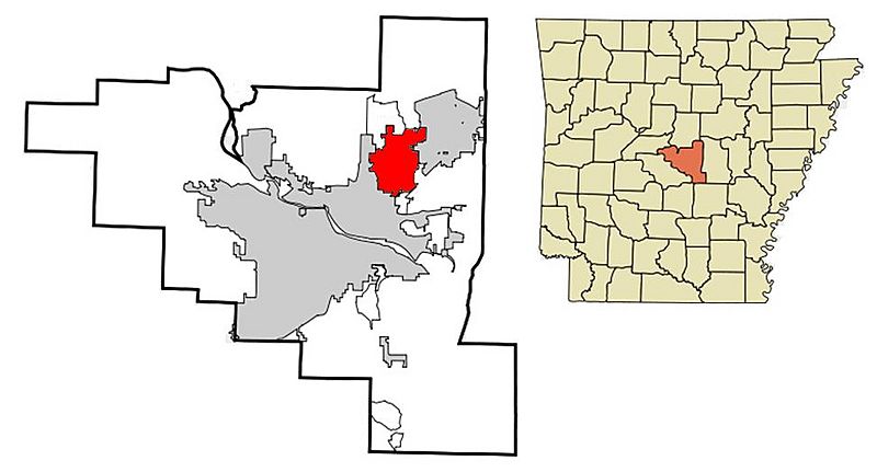
Image: Pulaski County Arkansas Incorporated and Unincorporated areas Sherwood Highlighted 2010

Size of this preview: 800 × 431 pixels. Other resolutions: 320 × 172 pixels | 973 × 524 pixels.
Original image (973 × 524 pixels, file size: 45 KB, MIME type: image/jpeg)
Description: This map shows the incorporated and unincorporated areas in Pulaski County, Arkansas, highlighting Sherwood in red, after 2008 Gravel Ridge annexation.
Title: Pulaski County Arkansas Incorporated and Unincorporated areas Sherwood Highlighted 2010
Credit: Pulaski_County_Arkansas_Incorporated_and_Unincorporated_areas_Sherwood_Highlighted.svg
Author: Pulaski_County_Arkansas_Incorporated_and_Unincorporated_areas_Sherwood_Highlighted.svg: Arkyan derivative work: --ARTEST4ECHO talk
Usage Terms: Creative Commons Attribution-Share Alike 3.0
License: CC-BY-SA-3.0
License Link: http://creativecommons.org/licenses/by-sa/3.0/
Attribution Required?: Yes
Image usage
There are no pages that link to this image.

All content from Kiddle encyclopedia articles (including the article images and facts) can be freely used under Attribution-ShareAlike license, unless stated otherwise.