
Image: Puyallup Reservation map 1892
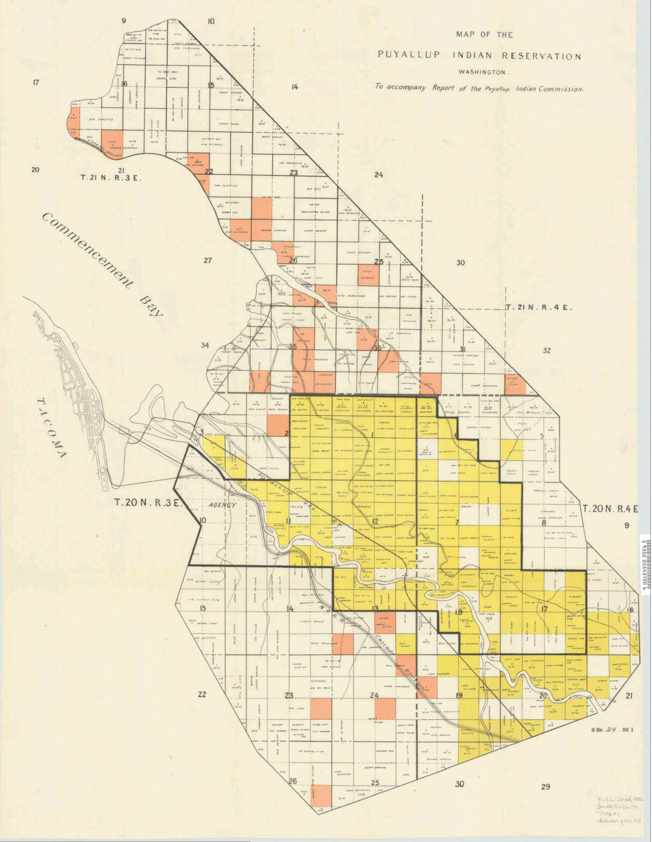
Description: Message from the President of the United States, transmitting the report of the Puyallup Indian Commission and accompanying papers. Washington : G.P.O., 1892. (Ex. Doc. / 52d Congress, 1st Session, Senate ; no. 34). Removed from: Executive documents of the Senate of the United States for the first session of the fifty-second Congress, 1891-'92 Color cadastral map of the Puyallup Indian Reservation, indicating land ownership and acreage of plots. Divided into sixteenth sections. Includes creeks and railroads. Township range is given. Also includes part of Commencement Bay and Tacoma. Indexed in: CIS US serial set index, pt. 14, 2892 (52-1) S.exdoc. 34, map 1. Scale ca. 1:22,500
Title: Puyallup Reservation map 1892
Credit: via University of Washington/Washington State University Digital Collections http://content.libraries.wsu.edu/cdm/singleitem/collection/maps/id/219
Author: President of the United States, transmitting the report of the Puyallup Indian Commission
Usage Terms: Public domain
License: Public domain
Attribution Required?: No
Image usage
The following page links to this image:
