
Image: Quebec1775FrenchMap

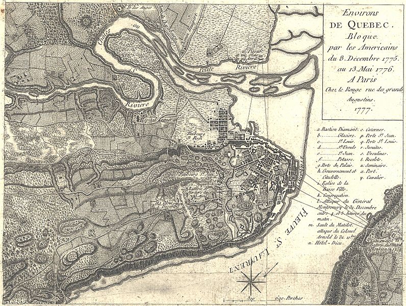
Description: This is a 1777 French map showing the Battle and Siege of Quebec, December 1775 to May 1776. It has had its border cropped, and had slight contrast and brightness adjustments made. The caption reads: Environs de Quebec Bloque par les Americains du 8. December 1775 au 13. Mai 1776. Translated: Quebec area besieged by the Americans, December 8, 1775 to May 13, 1776.
Title: Environs de Quebec. Bloque par les Americains du 8. Decembre 1775 au 13. Mai 1776.
Credit: This map is available from the United States Library of Congress's Geography & Map Division under the digital ID g3454q.ar061000. This tag does not indicate the copyright status of the attached work. A normal copyright tag is still required. See Commons:Licensing for more information.
Author: Georges Louis Le Rouge
Usage Terms: Public domain
License: Public domain
Attribution Required?: No
Image usage
The following 2 pages link to this image:
